


Avenza Blog
We are excited to announce the release of MAPublisher 12 for Adobe Illustrator, the latest…
We are excited to announce the release of MAPublisher 11.8 for Adobe Illustrator and Geographic…
We are excited to announce the release of Geographic Imager version 7.0, the latest version…
We are thrilled to announce the release of MAPublisher version 11.7, the latest update to…
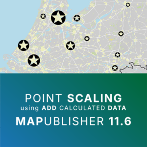
We are thrilled to offer a deeper dive into another helpful enhancement new to MAPublisher…
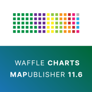
We’ve recently added a deliciously useful feature to MAPublisher: waffle charts! Waffle charts are grid-based visualizations where…
We are excited to announce the release of MAPublisher version 11.6, the latest update to…

In this edition of Cartographer Chronicles, we interviewed Craig Molyneux, a veteran of the cartography…
In this Map Spotlight, we are showcasing the Grand Prize winner of the 2024 Avenza…
- 1
- 2
- 3
- …
- 26
- Next Page »