Avenza User Conference Speakers
Have a great idea or workflow you’d like to present at next year’s conference?
2024 Speakers Bios and Presentation Topics

Ted Florence
President, Avenza Systems
Ted Florence is the President of Avenza Systems and directs the company in coming up with innovative solutions to the problems that plague the map-makers and map users of the 21st century. He is a professional engineer, who spent seven years as an international executive for a major pharmaceutical company followed by two years in the toy industry before joining Avenza in 1997 as an investor and vice president. Ted took over the ownership and presidency of Avenza in 2000 and has seen the company grow annually under his watch with a number of exciting and innovative products.
Opening remarks

Ivy Adamakopoulou
Chief Executive Officer, Anavasi
Ivy Adamakopoulou is Anavasi’s CEO, Greece’s leading cartographic company. She is a mountain person, a keen hiker and cartographer. Since 2022, she has started working with the Fire Service for outdoor map solutions and is training the Greek Forest Fire Fighters’ Fire Observants division since 2023 using Avenza.
From Outdoor Recreation to Mapping Fire Scars

Göran Bengtsson
Owner, Historiska GIS-kartor
Göran Bengtsson is a trained archaeologist at the University of Gothenburg, Sweden, with a special interest in our oldest remains from the late Paleolithic and older Stone Age periods, but also in cultural geography. He has also participated in several excavations of Stone Age settlements. In recent years, however, he has focused his research on much younger cultural remains, such as the inventory of older agricultural landscapes, water-powered mills, crofts and other interesting cultural remains. Göran has been very interested in cartography since his early youth and now with his retirement and free time he has spent thousands of hours correcting historical maps. He has also conducted courses where he has taught native researchers how to take advantage of historical maps and Avenza Maps.
How to Make, Use, and Take Advantage of Rectified Historical Maps

Jack and Jude Binder
Secretary, Wildcare Friends of Macquarie Harbour and Waterways
Jack and Jude are very experienced wilderness explorers. They began by exploring Africa, north to south, in the late 1960s. And then became adept at navigating across oceans, sailing over a quarter million miles, using celestial navigation to find their way. They still sail and live aboard Banyandah, their floating home.
Their time in the forest began in the 1990s when their skills were used by Parks to find disused mine shafts from olden days that are now in National Parks. Now, Jack and Jude are helping to look after the environment, and encouraging as many as they can to get connected to Earth in the hope humanity can still save the beautiful planet we call home.
Avenza Maps in Tasmania’s Wilderness

Tristan Lyttle
Senior Product Manager, Avenza Systems
Tristan Lyttle has been with Avenza since 2011 when he started as a Support Specialist. Since then, he has progressed through Avenza working with QA, the Map Store team, and now as a Senior Product Manager with Avenza Maps. Currently, his focus is on turning the feedback we receive from our users into real features and solutions in Avenza Maps.
Avenza Maps: Charting Progress

Oliver Normanton
Desktop Product Manager, Avenza Systems
Oliver Normanton is the Desktop Product Manager responsible for the growth and development of Avenza Systems desktop-based products: MAPublisher and Geographic Imager. Oliver graduated with honours from the University of Hertfordshire with a BSc in Physical Geography. He then spent a year with the Glaciological Research Team before moving to Toronto to begin his career in cartographic software development at Avenza.
Charting the Course Ahead: The Future of Mapping in Adobe with MAPublisher and Geographic Imager

Deborah E. Padilla, LMSW, CTP
Therapist, Author, Podcast Host, PATHS WITH HEALING Inc.
Deborah E. Padilla is the founder of PATHS WITH HEALING, Inc., and the HIKING IS MY THERAPY blog and podcast. She specializes in nature therapy and adventure therapy, focusing on anxiety, depression, and trauma. Deborah is a Ph.D. Candidate in Social Work and has a Master’s in Social Work from Yeshiva University. In her free time, she enjoys volunteering for causes promoting the wellness of the environment and improving the quality of life for others.
Exploring the Intersection of Technology, Nature, and Mental Health

Tom Patterson
Cartographer, U.S. National Park Service (Retired)
Tom Patterson worked as a cartographer at the U.S. National Park Service, Harpers Ferry Center, until retiring in 2018. He has an M.A. in Geography from the University of Hawai‘i at Mānoa. Presenting terrain on maps is Tom’s passion. He publishes the ShadedRelief.com website and is the co-developer of the Natural Earth dataset and the Equal Earth projection. Tom has served as President and Executive Director of the NACIS. He is now Vice Chair of the International Cartographic Association, Commission on Mountain Cartography.
Creating the Blue Earth Bathymetry Dataset

Richard Rasch
Owner, Custom Course Maps
Richard Rasch lives in Saint Paul, Minnesota and has been mapping disc golf courses for almost 25 years. He got his start working with GIS data in 2001 after discovering MAPublisher Lite would allow the import of TIGER/Line Shapefiles into Adobe Illustrator. A former high school choir director and computer graphics teacher he earned a certificate in GIS and is always fascinated by the way art and science intersect. He formed Custom Course Maps to create and publish highly detailed maps and signage for outdoor recreational activities with an emphasis on mapping terrain and elevation.
Tailoring Elevation Data for Maps with Small Footprints

Sid Sharma
Product Marketing Specialist, Avenza Systems
Sid has an Hon BA from Cardiff Met. University in Business, and a postgraduate certificate from Fanshawe College in Management with a specialization in Marketing. With a passion for exploring international cultures, his education and experience span across various countries as well as industries. Sid helps us deliver an enhanced and consistent experience with our product and communications to our diverse user base.
Avenza Maps: Charting Progress

Hans van der Maarel
Owner, Red Geographics
Hans van der Maarel is a long-time MAPublisher user and Avenza partner based in The Netherlands. With the team at Red Geographics, he enjoys helping customers get the most out of MAPublisher. Hans is also a former NACIS board member.
Red Academy: A New Learning Platform for Avenza

James Vooght
Owner/Photographer, James Vooght Photography
James Vooght is a Photographer based out of his home area in the Lower Hudson Valley of New York. A passionate artist specializing in landscape, nature and wildlife photography, James spends a significant amount of time sharing his love of regional parks and landmarks. He provides photographer education for newer and aspirational photographers through his work, YouTube videos, and writing all while working full time as a Wireless Network Engineer serving clients in the Hudson Valley Region.
Trails to Frames: A Photographic Journey with Avenza

Marikka Williams
GIS Professor, Fleming College
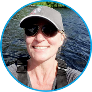
Marikka is a GIS Professor for the GIS (Cartography and Applications Specialist) Post Diploma program, the Environmental Technician program and Common First Semester at Sir Sandford Fleming College, a Mapping and Technologies Spatial Data Strategies Chair and Cartouche Co-Editor for the Canadian Cartographic Association (CCA). She is also a former Eastern Section Director for BeSpatial Ontario and a former GoGeomatics Peterborough Group Leader / Event Organizer. She is a graduate of the University of North Texas and has been GISP certified by GISCI since 2008. She has 20+ years of experience in the field of GIS. Her work experience includes providing GIS services to support Municipal Operations and the Engineering Consulting Industry, as well as educating College students about various aspects of GIS in her role as a Professor. She joined Fleming College as a GIS Professor in 2014 and teaches Spatial Analysis, Geovisualization (Cartographic design techniques), Municipal Mapping and GIS, Geomatics in Surveying (field survey techniques), Remote Sensing and Fundamentals of Geomatics. As Mapping Technologies and Spatial Data Chair for the CCA, she seeks to build awareness around spatial data analysis and mapping technologies to deliver spatial information that supports business practices in both public and private sectors.
SUP with Avenza Maps
Conference Hosts

Rebecca Bennett
Support Manager, Avenza Systems
Rebecca is the Support Manager at Avenza Systems Inc. and has worked with the company for over four years. She has a degree in Classics and Archaeology from Wilfrid Laurier University and a Post Graduate Certificate in GIS with cartographic specialization from Fleming College. Rebecca enjoys assisting Avenza users and listening to their different use cases for Avenza Maps, MAPublisher and Geographic Imager. In her spare time, she enjoys travelling and collecting maps and postcards.

Paul Edwards
Account Manager, Avenza Systems
Paul has been a part of the Avenza Systems Inc. sales department for over three years. He graduated with a degree in geography and a post-graduate certificate in GIS along with 15+ years of experience in the geospatial industry. This knowledge and experience help him understand and connect users with the solutions they need to be successful.


