My Account     Contact Us     Cart

Best Practices for Processing and Importing Maps into the Avenza Maps App

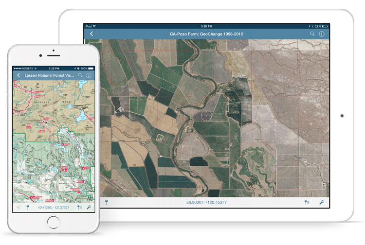
Avenza Maps is capable of importing and displaying georeferenced maps in several different formats. The app processes a map by rasterizing and tiling it on import. The speed and result of processing will vary depending on the type of file used and the size and dimensions. We’ll discuss the types of files allowed and the advantages of each.

Usually larger files take longer to process than smaller ones with some exceptions. An image may have a very high resolution but a small disk size due to image compression. It is recommended that images be less than 100 megapixels for upload to the app. A geospatial PDF file with many vector features may also take a long time to process. In this case, you should convert the file to an image to avoid having to rasterize vector data in the app.

Maps can be loaded into the app faster by processing them before import. Maps can also be preprocessed by uploading them to the Avenza Maps Store or using the Export to Avenza Maps tool in Geographic Imager or MAPublisher.

Comparison of Allowed File Types

GeoTIFF

A GeoTIFF is a TIFF file (Tagged Image File Format) with spatial information embedded in the file. This format is typically the preferred format for uploading directly to Avenza Maps without preprocessing. Since this is an image format, the app doesn’t need to rasterize the file on import meaning processing times will generally be faster compared to PDF’s, and it will maintain the native resolution.

It is also possible to import a normal TIFF file by zipping it with a TIFF World File (TFW) and either a WKT or PRJ file which contains projection information. It is best not to do this for the sake of simplicity. Usually, any GIS software that can produce a world file will also be able to save to GeoTIFF.

Geospatial PDF

A Geospatial PDF stores spatial data in either raster or vector format as well as associated attributes and layer information. Files should comply with the Adobe Acrobat PDF 1.7 specification which has been standard since 2006.

Avenza Maps rasterizes geospatial PDF files on import which discards layer and attribute information. PDF files typically take longer to process than image files. There is also a chance that the file may process incorrectly (e.g. discarding labels).

Despite this, there are some instances when it may be preferable to use a geospatial PDF file. For example, the map may already be in this format and isn’t worthwhile to convert to another format. Geospatial PDF files tend to be smaller than image files so they would be a good solution if device storage space or download speed is an issue. Also, occasionally converting from PDF to TIFF degrades the image quality and may make maps illegible.

To ensure a geospatial PDF file has a good balance between size and quality, open the file in Adobe Acrobat and go to Advanced > PDF Optimizer. This is especially helpful if the map contains large raster images.

JPEG

JPEG is an image format like TIFF but it does not have the ability to store spatial information. To load a JPEG into Avenza Maps, it must be zipped with a JPEG World File (JGW) and either WKT or PRJ file. JPEG files are compressed so this may be an option to consider if file size is a consideration, however, a better alternative would be to compress a GeoTIFF file.

Processing Maps with MAPublisher, Geographic Imager, and the Map Store

It is best to process maps before loading them into the app because desktop computers are more powerful than mobile devices. It also avoids having to process the file each time the map is loaded onto a device. Geographic Imager and MAPublisher each have a utility to export to an Avenza Maps package with the capability to upload directly to the Avenza Map Store if you have a vendor account.

Running these utilities produces a folder that contains a ZIP file with a thumbnail to show a preview of the map, a reference file, and a folder called tiles that contains a tiled version of the map in PNG format. This ZIP file can be imported into the app in the same way as other files.

Uploading a map to the Avenza Map Store processes the map the same way. To use the store, register a vendor account on the Avenza Maps website.

Using QR Codes to Deliver Maps Electronically

Updated: August 6, 2015 – New URL syntax for QR codes

Delivering mobile maps just became even easier for Avenza Maps vendors. This is a brief overview of how vendors can easily create QR codes (Quick Response Codes) to help promote, sell, and deliver their maps electronically.

A QR code is a two-dimensional barcode that can be easily scanned using any modern mobile device. When scanned, the mobile device automatically launches a web browser to direct the user to a website or other action. In our case, the map product page (free or purchase) in the Avenza Map Store.

These QR codes can be strategically placed on printed maps, signage, websites, advertising and anywhere else your maps are promoted.

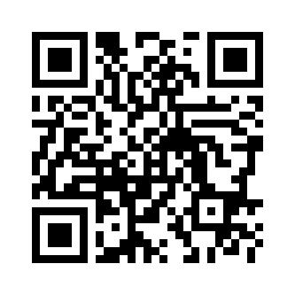
This is an example of such a QR code:

When scanned on a device that has Avenza Maps installed, this code will automatically launch the Avenza Map Store listing for Avenza’s Amsterdam map. From there, one can browse details about the map and immediately purchase it. In this case, the QR code contains a special URL to which only the Avenza Maps app will respond.


Create a QR Code to launch an Avenza Map Store product listing

Previously, two types of URL syntaxes—one each for Android and iOS—were used to create QR codes for map downloads. This is no longer the case. With the most recent update to the Avenza Map Store, only one URL syntax will be needed to create QR codes compatible for both Android and iOS.

The new URL syntax now shares the same link from the Avenza Maps site and will look like this: http://avenzamaps.com/maps/{mapsku} (e.g. http://avenzamaps.com/maps/62190). Adding a title to the URL is optional: http://avenzamaps.com/maps/{mapsku}/{title}. If a title is added, any spaces in the title should be replaced with dashes. For example, a map listing that has a SKU number of 61290 and a title of Amsterdam Netherlands will yield the URL http://avenzamaps.com/maps/62190/amsterdam-netherlands. To retrieve the URL of one of your maps, go to your Avenza Map Store vendor page, view one of your map listings and copy its URL.

Once you’ve retrieved the URL of one of your maps, simply go to one of the QR code generators recommended below:

https://qrcode.littleidiot.be
http://www.visualead.com/qurify2
http://createqrcode.appspot.com
http://qrcode.kaywa.com

Some sites provide an option to download the QR code in different formats. We recommend saving the QR code as a high resolution image or SVG.


Examples of QR codes to deliver maps from the Avenza Map Store

As described earlier, QR codes can be used with Avenza Maps to drive a map purchase, but they can also be used to effect the download of any map within the Avenza Map Store.

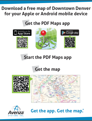
QR codes with the Avenza Map Store can be a very effective way to deliver a free map, such as those found in transit shelters, tourist offices, car rental counters, parks, and trail heads. In such cases, for example, a QR code can be placed on a transit map in a bus shelter or on a signpost at a trail head, and anyone equipped with the Avenza Maps app who may be looking at that map can scan the code and immediately get the map delivered to their device. Here is an example of such a sign Avenza used recently at an event in San Diego, CA.

Imagine seeing such a sign on a hotel concierge desk, city tourist office or in an airport and how easy it would be to quickly obtain a map for that city.

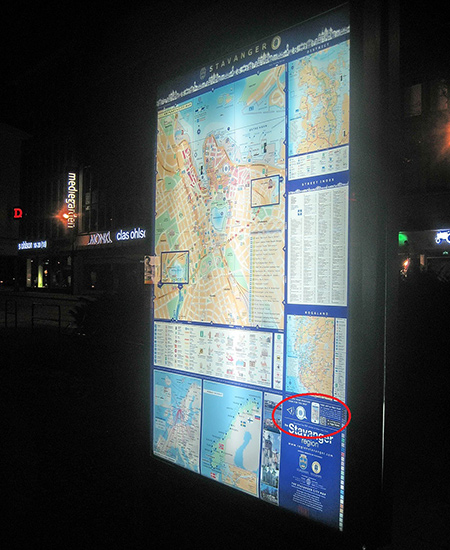
Here is an example of how the City of Stavanger, Norway has employed a QR code on their city maps placed in popular and high foot-traffic areas.


Photo and map courtesy of Stavanger Guide Maps Norway.
Notice the QR code in the lower right corner directing viewers to the Avenza Maps app.

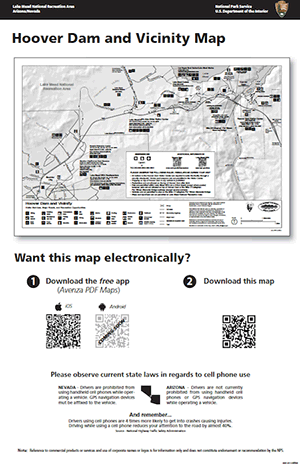
Lake Mead National Recreation Area has also implemented QR codes by adding them to posters placed in Visitor Centres and other strategic areas to allow visitors to get their hands on the park map before hitting the trails.

qrcode

What else can you do with QR codes and maps?

  • QR codes can be strategically placed on printed maps, signage, websites, advertising and anywhere else your maps are promoted.
  • They can be placed on a paper map product to offer a digital copy of the printed map to someone who buys the paper one.
  • They can be used in magazine and newspaper articles to offer a map for sale for a destination mentioned in the article. If a map is used in an article a QR code can be used to offer that map.
  • QR codes can be placed on websites to enable the purchase of a map that is shown and offered for sale on that website.
  • They can be used on maps and map signage, such as those in Stavanger or on a hiking trail head map sign, to offer the same map that someone may be looking at on the sign.
  • They can be used on signs on hotel concierge desks, travel agencies, airports and train stations and any other place where travels congregate.
  • The ideas one can come up with are endless and we encourage everyone reading this to explore and exploit the use of Avenza Maps QR codes in their sales and distribution tactics.

News Archive