


MAPublisher has been simplifying the process of making maps beautiful for cartographers for more than 20 years. We are always adding new features and improving others, some of which have impacted the overall workflow and affect a majority of users. Other are more ‘niche’ in their application and the functions they perform. Here are a few favourite features that you may, or may not be aware of, as identified by the people who helped design and build them.
MAP Tagger Tool Michael L. – Product Marketing
I like the MAP Tagger Tool because it’s incredibly fast to create labels by clicking features on the artboard. Labels are created using attribute data as a source for the labels. In dense areas, the Map Tagger has flexibility to style and attach leader lines according to placement rules.
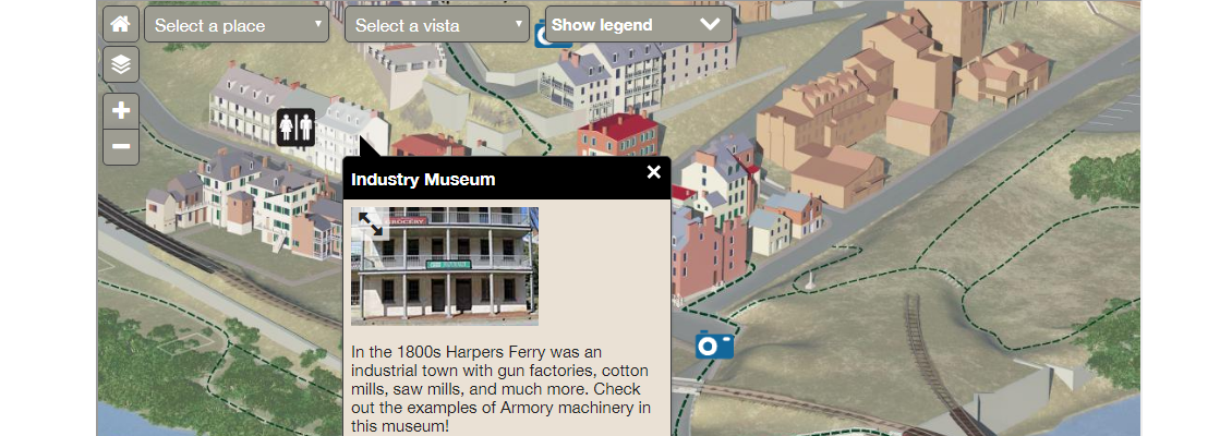
MAP Web Author Will H. – Sales
The MAPublisher users I speak with are usually impressed with Web Author and are surprised that it is included in the MAPublisher package. MAP Web Author lets Adobe Illustrator documents with GIS attributes be exported to interactive HTML5 web maps complete with callouts, rollovers, layer control, search, pan and zoom controls. With a little bit of knowledge of CSS (Cascading Style Sheets) and JavaScript you can embed interactive maps into any web page. The map below was created by the National Park Service.
Scale and Rotate by Attribute Andrew P. – Software Architect
We added this for a customer who had an interesting use case involving a pattern fill for lava flow. The map broke down an area into sub-areas by lava flow (direction, intensity, etc.). He wanted a way to use the attribute data he had in his map to automatically do a bunch of things he would otherwise have to do by hand, very carefully. In particular, he used the feature’s ability to rotate the pattern of area to match the lava flow direction, which sounded very cool (no pun intended) to us!
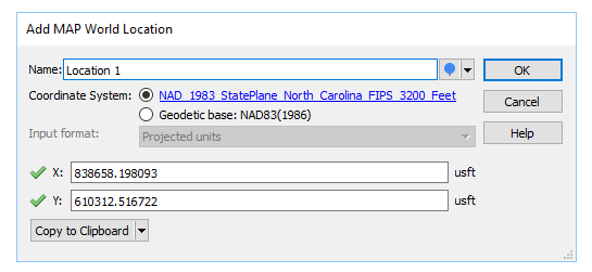
MAP Locations Tool Michael L. – Product Marketing
Most users don’t know what MAP Locations does (allows you to define real world coordinates for a location in a document) and how it’s actually useful. It sounds complicated, but it’s actually simple and far reaching throughout the product. MAP Locations can be used in several MAPublisher tools as references for georeferencing, for corners, for locations to draw lines, and locations to plot points. They can also be used to identify map and page anchors.
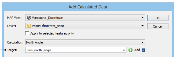
Add Calculated Data Andrew P. – Software Architect
Add Calculated Data is essentially a tool to update or add attribute data, but it allows users to feed in things that a user would find difficult to calculate themselves such as centroids, north angles, and art bounds. It also lets you pull in and store data like stroke or fill colours, in case you need to export them to a format that doesn’t support colours natively. You can even have it pull in elevation data!
The Avenza Resources Blog regularly published tips on how to use various MAPublisher tools. Detailed documentation is also available on our website.