My Account     Contact Us     Cart

Combining the Power of Avenza Maps and MAPublisher

Have you ever thought about using Avenza Maps and MAPublisher together? Perhaps you’ve wanted to record the details of your trip, and use MAPublisher to create a map of your own. In this blog, we’ll walk you through how to do just that. 

Every day after work I go for a 3km run on the same trails near the Avenza office. To track this I can download a map of Toronto from the Avenza Map Store. After opening the map, I can use the Tracking tool to begin tracking the course of my run. I also would like to collect points of some important locations throughout the park. This layer contains an attribute schema regarding information about the points: whether they have a gate, have a building, have a map, and/or have a telephone.

I would now like to export my layers from Avenza Maps to a file format that I can use in MAPublisher to create a map. From the Layers tab, I can use the export button to export my track and point layers to a shapefile and save it to my Google Drive account.

On my computer, I can download the zipped file with my shapefiles in it and extract it. I can then import my data and begin working on my map. I want my map to be simple and easy to read. It is only for personal use so it will not be exceptionally detailed beyond information I might need in case of an emergency during my run. 

After finishing my map, I can use the MAPublisher Export tool to save it as a Geospatial PDF file. I can then import it on the Avenza Maps app and use it during my next run. Now I’ve just created my own map using the data I’ve collected from the Avenza Maps app!

Download Avenza Maps Today

Start recording your next walk, run, or hike by using the tracking tool in the Avenza Maps app, and then you can export this data into MAPublisher to create your very own map for next time.

Download the Avenza Maps app today, available on iOS or Android!

Avenza Maps 3.5 Released

We’re excited to announce that we’ve completed the release of Avenza Maps 3.5 for iOS and Android.  This update contains new features and performance improvements as well as fixes for reported issues. Some highlights are mentioned below, for the full release notes see below.

Plus subscription. We’ve renamed the Unlock Map Imports subscription tier to Plus. The simply named Plus subscription tier will better align with more features that we’ll be introducing in the near future. This subscription still allows you to import as many of your own maps as you want—ideal for map and outdoor enthusiasts who enjoying sourcing and loading their own or third-party maps.

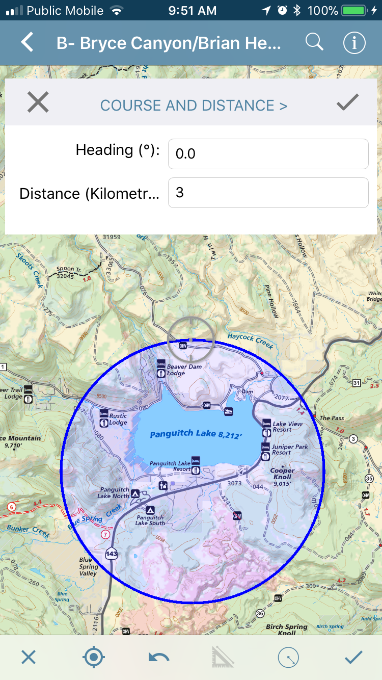
Active and inactive maps. In this release we’re introducing the ability to make imported maps (not including those downloaded from the Map Store) inactive. In previous releases, the standard version (without a paid subscription) allowed you to only import up to three of your own maps into the app and were limited from importing any more. However, now you’ll be able to import as many of your own maps as you’d like. The first three imported maps will be considered ‘active’ and available to use with all of the app’s functionality. Subsequent imported maps will be considered ‘inactive’. Inactive maps can still be opened and viewed, but without GPS location and map tools enabled. You will have the ability to delete active maps that you no longer use and then activate new ones to stay within the three active map limit. Maps downloaded from the Map Store (versus imported from an external source) are always location-enabled and are never limited. To import an unlimited number of your own maps with full location-enabled features and functionality, Plus and Pro subscriptions are available.

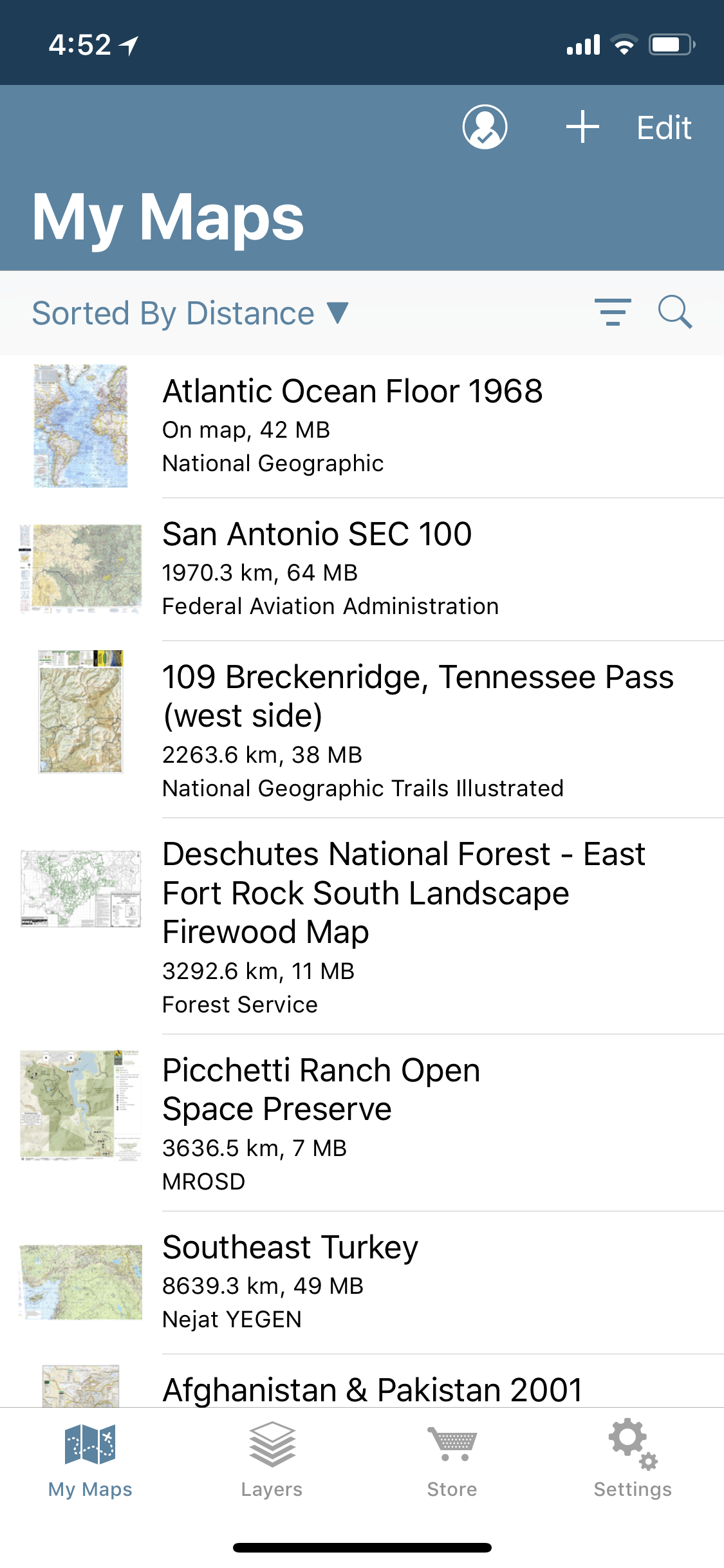
Sort and filter your maps. This release provides some handy sort and filter options on the My Maps screen. You’ll have the ability to sort by distance (how far away a map is from your current location), by name, by date, and by how much storage the map takes (measured in MB). In addition, you’ll now be able to filter maps to show only those from the Map Store, maps that you imported, folders and collections, active or inactive maps, just maps (no folders), or all items.


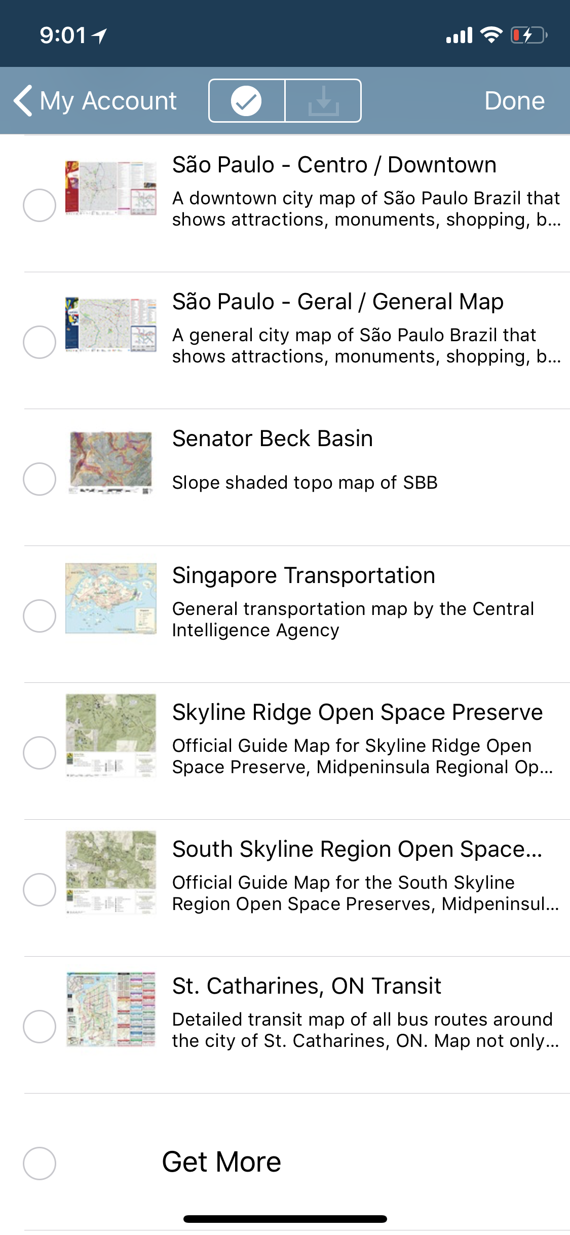
Map Store Login and My Account improvements. The user interface around logging and viewing your Avenza Maps account details has been vastly improved. You now have the ability to change your password, change your email, and view your download history. The Download History screen has new functionality as well. Previously you were only able to download one map at a time. Now you’ll be able to select multiple maps at a time and download in bulk. In addition, you’ll also be able to access map descriptions without having to go to the Map Store to look it up.


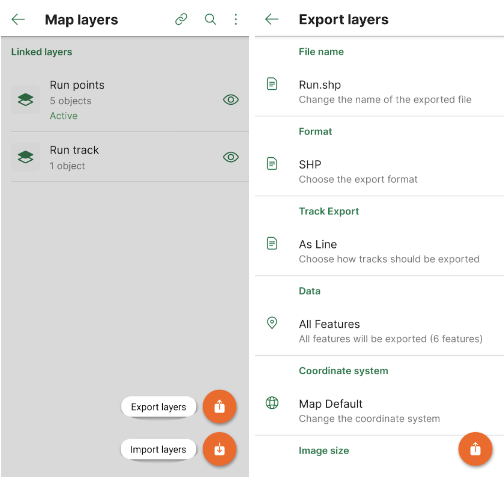
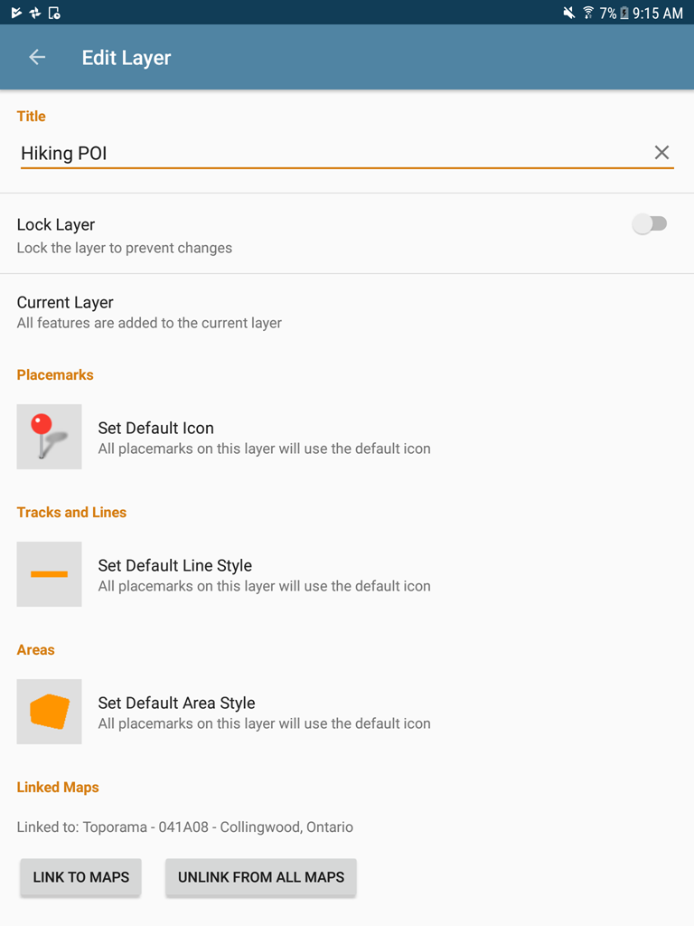
Layers now available on Avenza Maps for Android. Rejoice Android users, layers are finally here! Having the same functionality as the iOS version, map features (placemarks, lines, tracks, areas, photos, and schema) are now contained on layers. Map features can be managed here, including adding, deleting, and editing map feature information. In addition, the layers can be linked (and unlinked) to maps, so that map data can continue to be used even if a map is no longer on the device. Similarly, if that map is installed again, you’ll be able to link that layer to the map again. You’ll also be able to export layers data directly from the Layers screen without having to go into each map.


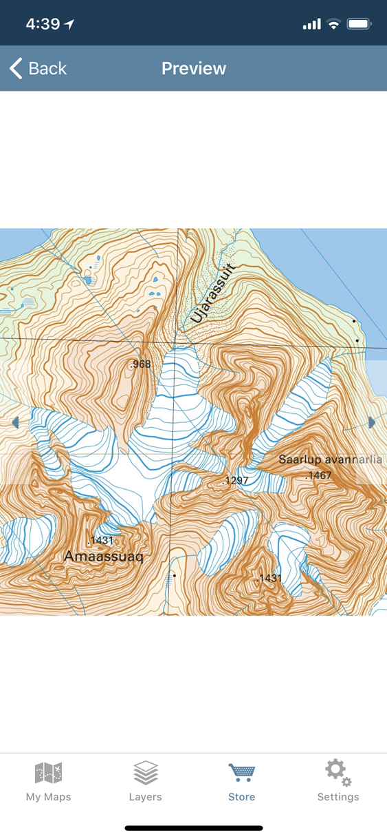
Better quality Map Store previews. All of the map listing previews in the Map Store have been updated and now have higher resolution of busy sections of the map to provide better detail of features, lines, labels, and colours.

Release Notes

  • User experience improvements, including sorting and filter options on the My Maps screen
  • Newly designed Map Store Login and My Account screens
  • Re-discover, select and re-download previously purchased Map Store maps using new options available on the Downloads History screen
  • Export Layers data directly from the Layers screen
  • Link a layer to any available maps or unlink from all maps from the Edit Layer screen
  • Better quality map previews in Map Store
  • More granular control of map features’ visibility
  • Manage, import or export your data independently of maps using the new Layers tab on Android
  • Brand new bottom navigation bar on Android


You can get Avenza Maps now from the App Store and Google Play.

Avenza Maps 3.3 released

We’re excited to announce that we’ve completed the release of Avenza Maps 3.3 for iOS and Android. We addressed some early user feedback and made a few point releases to resolve those issues (3.3.1 for Android and 3.3.2 for iOS). We’re also working on another minor update that addresses some additional user feedback.

Avenza Maps 3.3

This update contains new features and performance improvements as well as fixes for reported bugs. Some highlights are mentioned below, for the full release notes see below.

Redesigned Measure Tool. This tool has been completely redesigned and renamed — now known as the Draw and Measure tool. It features an improved interface which lets you draw shapes and measure more easily. While in a draw or measure mode, you can now quickly tap anywhere to enter a segment for a line or area. In addition, there are two precise input modes to enter segments: Point By Point and Course and Distance. Long press anywhere on the map to enter precise input mode. For Point By Point, simply enter the coordinates (lat/long, easting/northing or MGRS/USNG) to add a segment at an exact location. The Course and Distance mode allows you to enter the heading (angle) and distance from an initial location.

You can also now draw circles. Using only two points — an initial center point and a second point at any distance away — which means you can now draw circles that can act like buffers. It even works with the Point By Point and Course and Distance modes to enter specific distances or coordinates. Best of all, shapes and areas can now be saved as a map feature to your map. They can be exported as KML, CSV or GPX or even SHP (if you have Avenza Maps Pro). New style settings are available to adjust line thickness, stroke and fill colors, and opacity.

Release Notes

  • Redesigned Measure Tool (now known as “Draw and Measure”)
  • New advanced drawing capabilities, including tap anywhere to draw a segment and tap and hold to access “point by point” and “course and distance” modes
  • Draw, edit, save, export and import areas. Draw areas including circles using only two points.
  • Reorganized Settings including new settings to change location dot color and line and area colors including opacity
  • Record GPS Tracks will continue to run even when the map is closed
  • Map Store improvements including ability to preview map extent
  • Improved Map Store user registration workflow


You can get Avenza Maps now from the App Store and Google Play.

News Archive