We are excited to announce the release of Geographic Imager version 6.9, the latest version of our Geographic Imager® extension for Adobe Photoshop®.
With Geographic Imager v6.9, we are announcing official compatibility with Adobe Photoshop 2025 and macOS Sequoia, WMS 1.3.0 import capabilities, support for NITF metadata, and other user interface and usability enhancements.
Here’s what you can expect with the latest Geographic Imager v6.9 release:
Compatibility upgrades
Following our extensive MAPublisher compatibility upgrades earlier this fall, we are happy to share that Geographic Imager 6.9 is fully compatible with Adobe Photoshop 2025 (version 26), which was released this October. Geographic Imager 6.9 also supports the recently released macOS Sequoia (version 15).
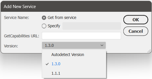
Import data from WMS 1.3.0
We have had many users request the ability to import data from Web Map Service (WMS) version 1.3.0, and we are happy to announce that this is now possible with Geographic Imager 6.9! This can be done by opening the Advanced Import window and following the usual steps to add a web map service. Select 1.3.0 from the new Version drop-down menu, or select the “Autodetect Version” option in this menu, which can detect the WMS version used by the URL provided.
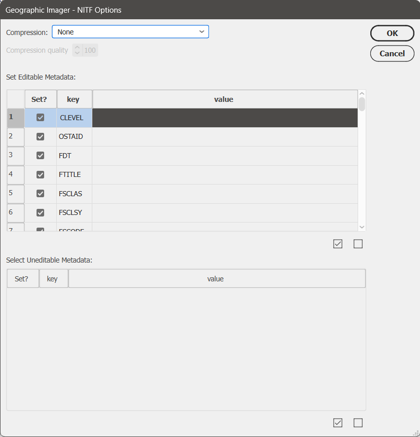
Support for NITF metadata
NITF metadata will now be maintained when you import NITF files into Geographic Imager. When you go to quick save a document to NITF file format, you will now be met with an “NITF Options” dialog box. Here you can specify image compression, edit certain metadata fields, and choose which metadata fields to include in your saved NITF file.
Geographic Imager 6.9 is Available Now!
If you would like to learn more about the new Geographic Imager 6.9 features or have any questions, please check out our Support Centre.
Geographic Imager v6.9 is available immediately, free of charge to all current Geographic Imager users with active maintenance subscriptions and as an upgrade for non-maintenance users.