In this edition of Cartographer Chronicles, we interviewed Craig Molyneux, a veteran of the cartography industry and the winner of the second runner-up prize in the 2024 Avenza Map Contest! Craig’s journey in the world of cartography is a testament to the passion, adaptability, and ever-evolving landscape of mapmaking. Sparking from an interest in graphic design and a love for the outdoors, Craig found his calling in cartography, blending artistic skill with geographic precision. From hand-drawn maps to the early days of digital cartography, Craig has always been on the cutting edge of the industry. Through his company, CartDeco, he has worked with major publishers, created award-winning maps, and inspired the next generation of cartographers. Craig is sharing his cartographic journey with us in his own words.
***
Discovering and Navigating the World of Cartography
At secondary school I had a real interest in graphic design, and also was interested in the outdoors. Using map products became second nature to me as I would be out camping and hiking most weekends. I had a little inkling that I would end up in Cartography, but I quickly discovered that graphic design was super competitive and only the elite made it through to university. After completing high school, when searching for a likely university course, Cartography jumped out at me, and I quickly embraced it. Back in the 1980s there were only a couple of universities in Australia that offered Cartography as a degree, and I went to RMIT University in Melbourne.
Over 40 years my career has taken me through the private and public sector, however I feel most comfortable working for myself. I feel there’s more creative freedom when you can focus and concentrate on the jobs that give you pleasure.
CartDeco started as a side hustle in the 1990s. When the early Apple Macs hit the market I bought a second-hand one, and using the very first version of Adobe Illustrator I started doing computerised mapping. Things were pretty basic back then (compared with what we have now), however I felt I was at the cutting edge using a desktop computer to create maps. Prior to that all of my cartography had been done by hand, either using pen and ink or scribe, peel-coat and stick-down type.
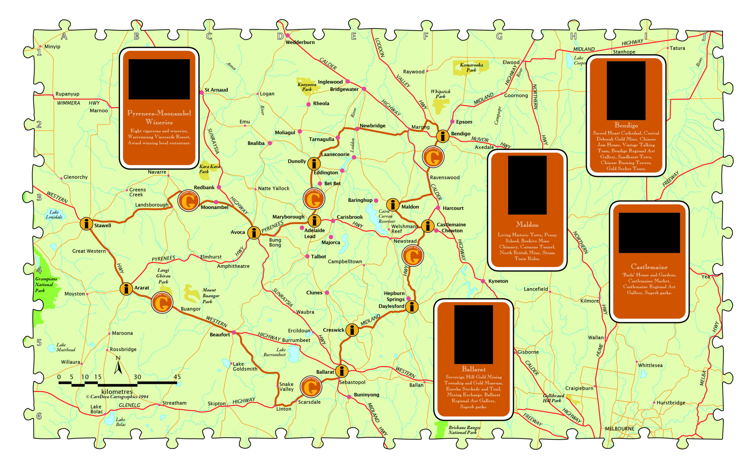
After producing maps for the tourism industry I was beginning to get known within the local publishing industry and CartDeco took off. I made a connection with Henry Boegheim, who had started Hema Maps, a Brisbane-based mapping company, and Henry asked me to produce maps for him, so that’s when I concentrated full time on CartDeco. Working in a home office at the back of a shed, CartDeco continued to produce maps for Hema Maps then slowly expanded to other publishers, like Australian Geographic, the AA in the UK, Universal Publishers, Hardie Grant Publishing and many more. I did have young graduates work with me from time to time and it was a pleasure to be able to mentor the cartographers of the future.
Very quickly after starting desktop-based cartography it became apparent that scanning and tracing linework was not the most efficient production method. I stumbled upon Avenza’s MAPublisher in its very early days. I think I was one of the early adopters. Back then it could import a few geospatial datasets and that was about all, but now it’s grown to be a fully-formed production tool, essential in my cartographic workflow. Being one of the only Australians using the application I was approached by Ted Florence to be a local distributor for the software. I did this for a number of years, providing training and support for local users before handing over to Gavin James at Mapuccino.
Career Highlights
I’ve been lucky enough to work on some fabulous cartographic projects and work with some great people over my cartographic journey. As Hema Maps began to expand, in 1998 they had a vision to map the centre of Australia like never before. Sending out field teams to map the roads and features of our vast continent, they asked me to compile six maps covering about two thirds of Australia. This was a daunting task. Open data was just being thought of and Geoscience Australia, to their credit, had made available their 1:250,000 dataset of Australia. As was soon discovered, data in remote and rural areas was unreliable and many years out of date. MAPublisher was used to create this first series of maps, importing 1:250,000 data into Adobe Illustrator and combining it with GPX routes that had been collected by the on-ground team. Comprehensive field notes were used to add “meat to the bone” of the map, with many unique and culturally significant details added that had never before appeared on published maps.
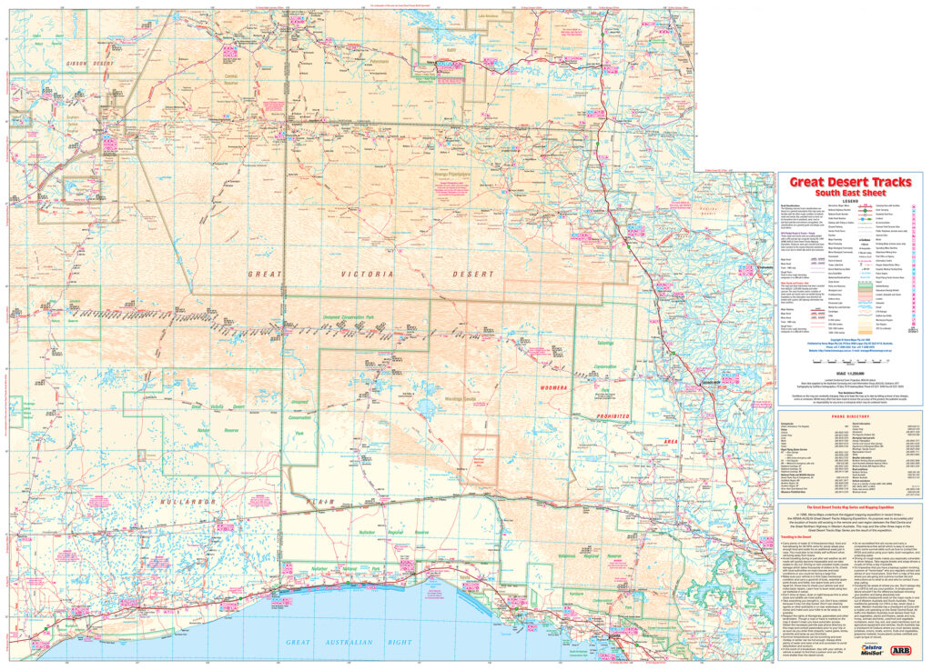
Entitled Great Desert Tracks, the series of six maps at a scale of 1:1,250,000 enabled the new generation of 4×4 explorers to safely travel in Australia’s outback. The series is now into its 9th edition.
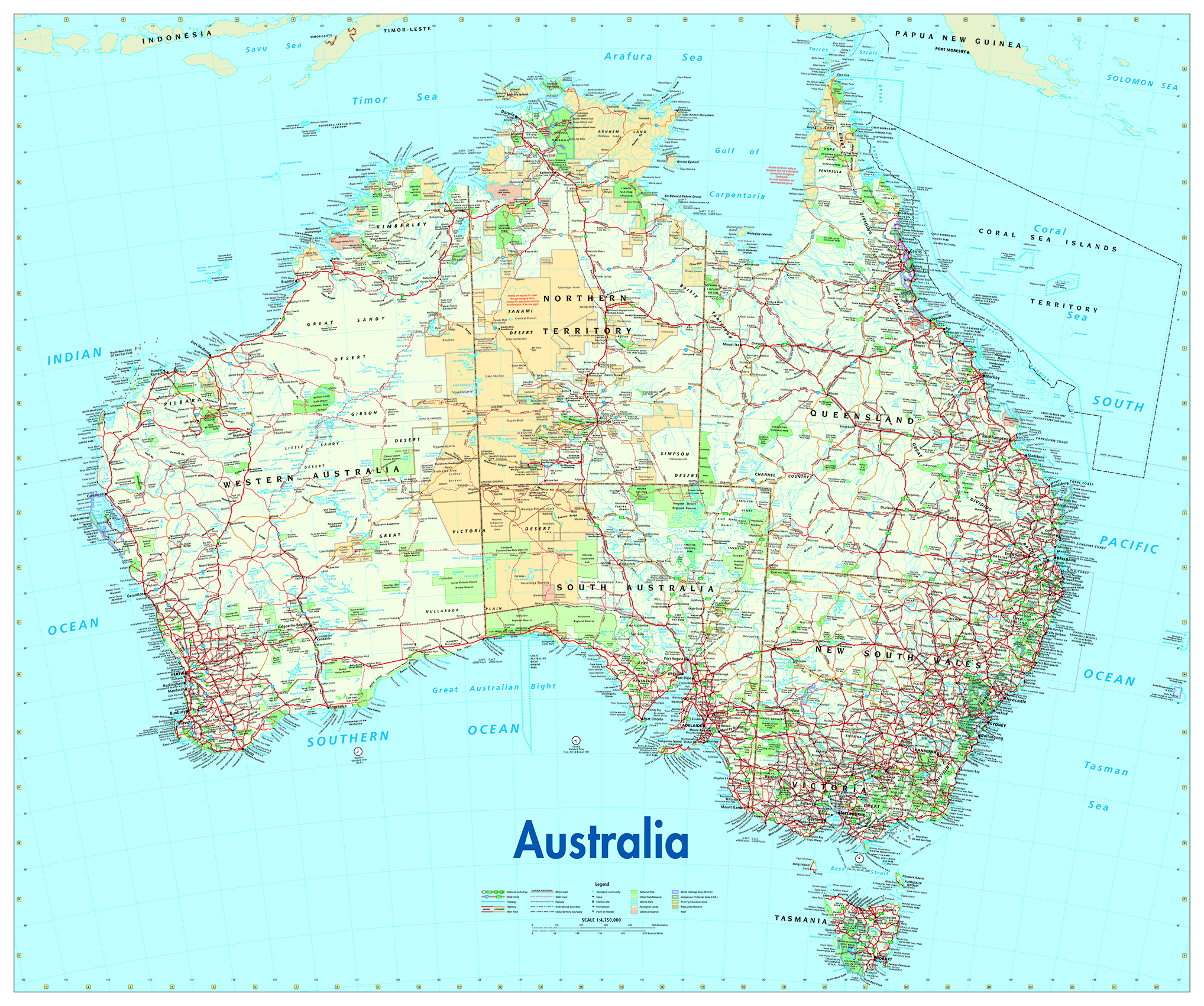
A key relationship I made early on was with the senior cartographer at Australian Geographic (AG) magazine, Will Pringle. Will became a long-standing friend and mentor, who sadly passed away in November 2024. He had a profound impact on my career and was generous with his knowledge and wisdom. Will asked me to update AG’s Australia for Adventurers and Dreamers map for the magazine. This became a staple product for many years and ended up on many a child’s bedroom wall.
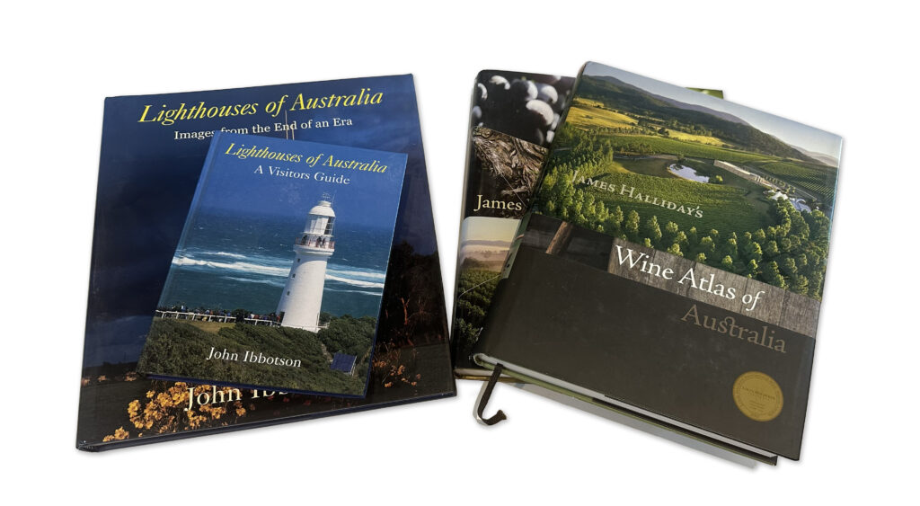
I’ve enjoyed commissions for small and large jobs, from a simple map for a brochure to large atlas projects with maps numbering in the hundreds. One project that I was particularly pleased to contribute to was the Jacaranda School Atlas, published by John Wiley and Sons. As a secondary school geography student I used an early edition of this atlas and it has been a mainstay in Australian secondary schools ever since. I was lucky enough to be asked to work on the 7th, 8th and 9th editions of the atlas and to revise the design to a more contemporary style. Originally the atlas plates were created using ArcGIS, as this was felt that it would be easier to update and index the atlas, however over time we realised that this was not the case and a production approach using MAPublisher was simpler and indexing was easier. Other atlas commissions included editions of the James Halliday’s Wine Atlas for Hardie Grant Publishing and various titles for Lighthouses of Australia.
Whilst it’s nice to design and produce maps for clients, it’s especially nice to design, produce and publish your own maps, and over the past five years I’ve been creating large wall maps for use in either the classroom or as a collectible piece of art for the living room or office.
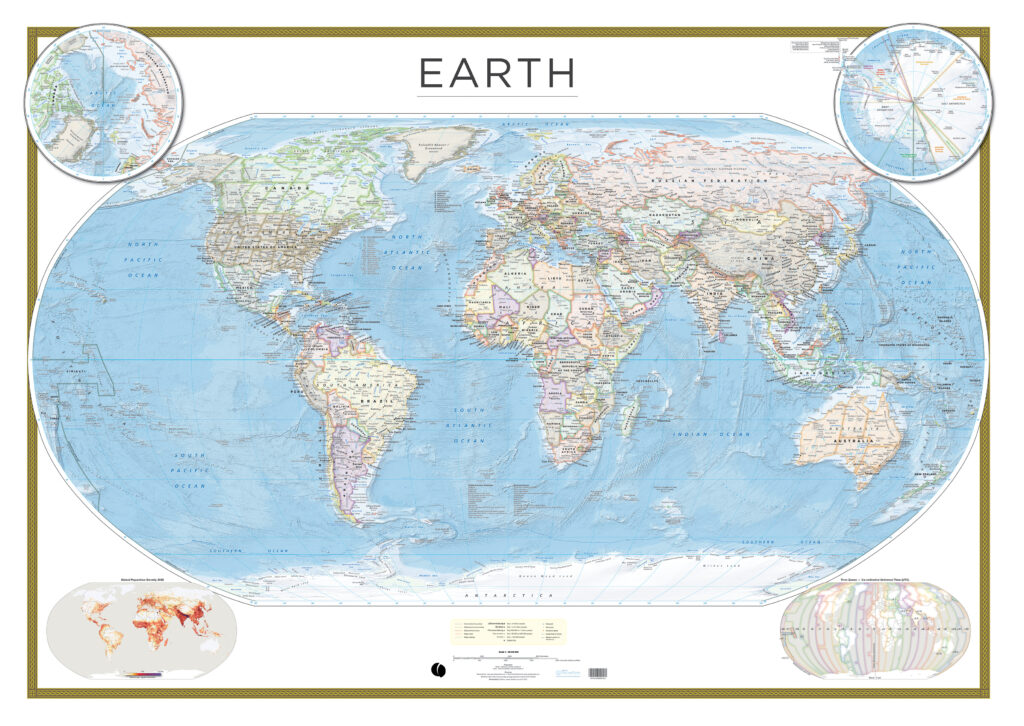
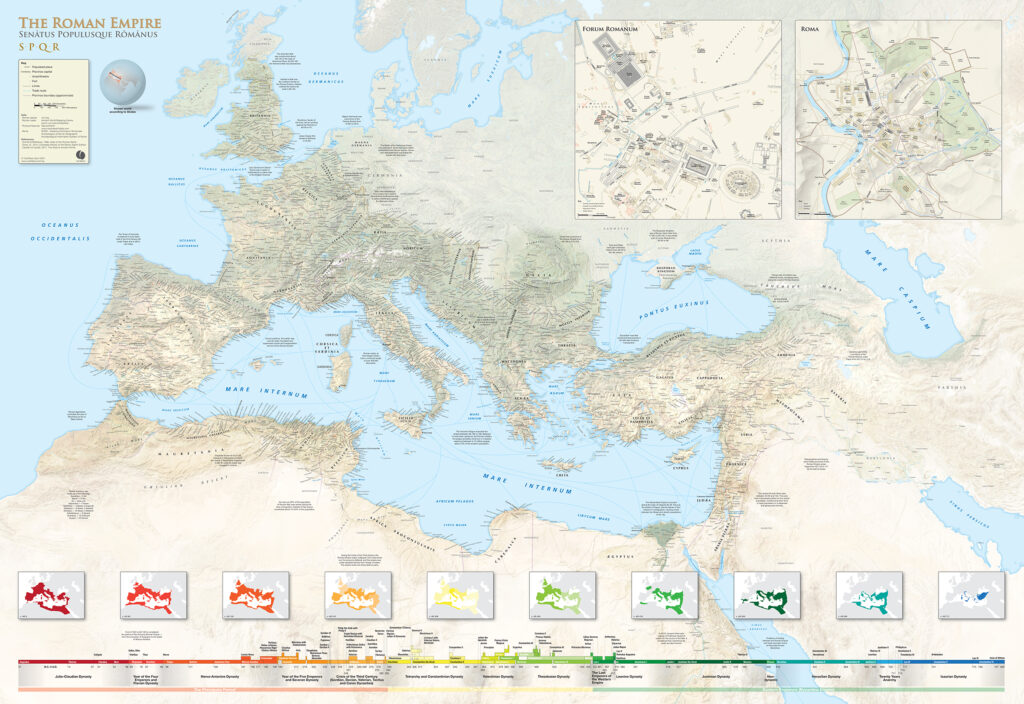
The Earth Wall Map has been a passion project combining the latest global datasets (including Natural Earth Data) to present a view of our world like no other. My interest in all things Roman has led to the creation of the Roman Empire wall map (which won the second runner-up prize in the 2024 Avenza Map Contest). After ten years of research and production it has finally seen the light of day. Measuring in at 1600 x 1100 mm the map is a valuable tool for researchers and educators.
Cartographic Methods
Technology has impacted our profession immeasurably. As new software tools have come along, and computing power has increased, we have been able to make new and improved cartographic design choices. The provision of detailed open digital elevation data and satellite data, along with improvements to 2D and 3D imaging tools, has improved the types of maps we produce.
My typical workflow is to use PostgreSQL for data storage, QGIS for data manipulation and editing, with the finishing of artwork in Adobe Illustrator and Photoshop. I also use tools like Natural Scene Designer Pro and Eduard for creating relief, and Avenza Geographic Imager for reprojecting imagery and relief. I do like experimenting with other tools as they come along, like Blender for example, and I’m dabbling in the use of drones to collect detailed base imagery and using WebODM to stitch images and create surface models.
You’re never too old to learn new methods using new tools, however there are fundamental cartographic principles that still apply when compiling a map. I’m not a big fan of maps created out of GIS applications that use auto styles and auto labelling. Whilst this has improved in recent years they are still easy to spot and lack the craftsmanship of a well designed map.
The Avenza suite of applications has proven itself over the years to be fit-for-purpose in map production. I’ve used Esri ArcGIS and QGIS for map production, however these don’t really suit my creative needs. For clients in the publishing industry, there is a need to provide artwork in Adobe Illustrator or pdf format. Being able to maintain geographic referencing and layers in the final output is critical. I enjoy the seamless integration between Illustrator/MAPublisher and Photoshop/Geographic Imager when working with projections.
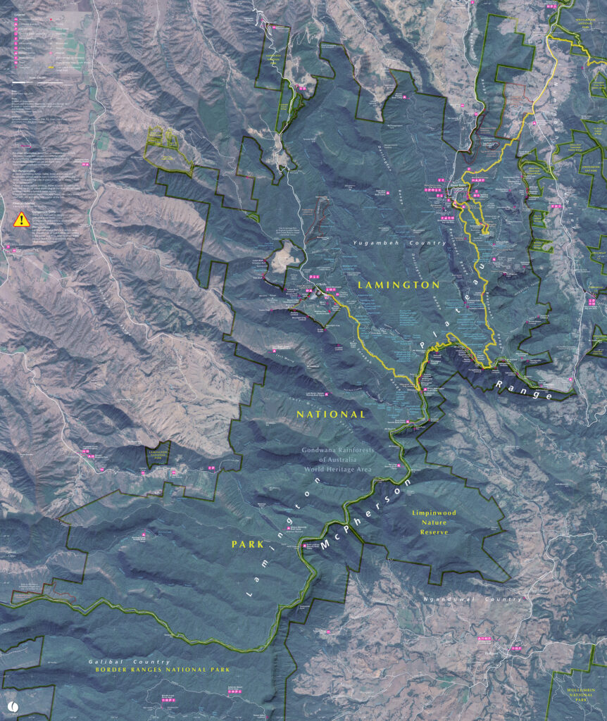
Recently I have been producing a series of walking maps solely for the Avenza Maps app. Using open data sources like OpenStreetMap and Sentinel imagery, a walking map can be quickly produced for any area on the planet. Additionally the Avenza Maps app is used for field checking the map prior to publication. The whole Avenza Map Store ecosystem works well for me, from publishing, promoting and accounting of sales.
What’s Next?
History is an interest of mine and combining this with cartography I see an opportunity to create more maps like the Roman Empire wall map on specific themes. My next map in production is a wall map of the conquests of Alexander the Great.
My indigenous heritage gives me a deep connection to place. My ancestors have been on this continent (Australia) for at least 40,000 years. In Australia it’s been a challenging few years getting the broader non-Aboriginal population to give the Traditional Owners a Voice to parliament. What that exercise has shown me is that there’s much education to be done around our long-standing history and connection to the continent we now call Australia. Geographic place naming is one area where countries like Australia, with a very brief colonial history, can embrace the rich stories that connect us to place. Stories that go back over a thousand generations have been used to connect us to features in the landscape. The stories are ever-evolving and provide a multi-layered view of place. Place is described through song, dance, art and story. Rather than name features after recent arrivals, battles or long-dead members of the British aristocracy, we have an opportunity to promote unique culture through language and place naming. By imbuing data and maps with the rich cultural heritage of place we give everyone a deeper connection to place.
Insight for Aspiring and New Cartographers
Our industry is a very niche one, and what I’ve discovered over my cartographic journey is just how friendly and helpful everyone is. Other cartographers genuinely care about your success and are happy to assist you with either helpful technical advice or putting you in touch with the right people. If you’re starting out on your cartographic journey, reach out to those whose work you admire. Their enthusiasm and care may surprise you. Feel free to contact me any time if you have technical questions (I can’t guarantee I can answer the tricky ones) or just need advice on how to get your passion converted into a small business. My email is craigmolyneux@mac.com.
Check out our other Cartographer Chronicles blogs here!


