My Account     Contact Us     Cart

Cartographer Chronicles: Thorfinn Tait

Cartographer Chronicles Thorfinn Tait

A teacher by day and a cartographer by night, Thorfinn Tait (a native of Scotland) has been teaching high school in Japan for almost 20 years while making maps of fantasy lands in his spare time.

Mapping is a hobby for Tait, and his deep love of atlases, along with fantasy role-playing games (known as RPGs), helped drive him towards creating his own maps of fantasy worlds. He started in 2005, making maps in Adobe Illustrator. His goal was to create an atlas of a fantasy world, that included the same variety of maps that you’d find in any traditional world atlas — topographical, political, thematic — along with all the tables of data typically found in an atlas. He chose to map the world of Mystara, a popular Dungeons & Dragons (D&D) campaign setting from the 80s and 90s.

Tait set out to compile all of the original maps of Mystara (more than 250 of them) into a cohesive whole. “One of my biggest struggles was trying to work out what projection Mystara’s maps used. But there was a fundamental disconnect for me in that Illustrator alone did not have the functions I needed,” says Tait. “For example, to change the projection of a map, I tried to use it in tandem with other GIS software, but it was very troublesome having to constantly import and export elements between programs.”

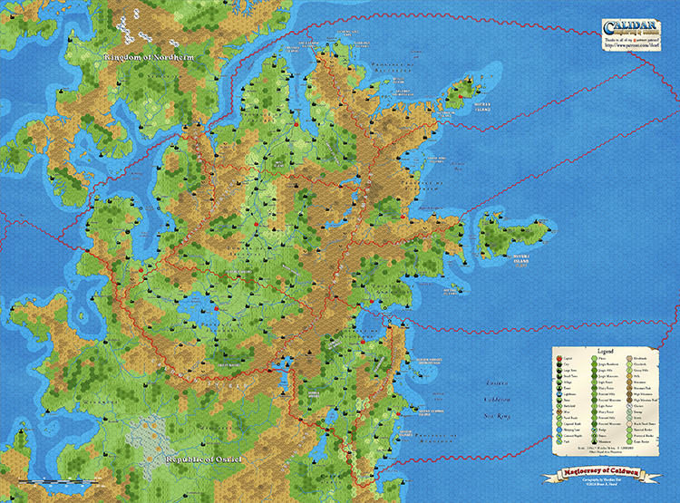
Map of Caldwen

©2019 Bruce A. Heard. World of Calidar™ Fantasy Setting.

While working on the Atlas of Mystara project, an original Mystara author made a return to the industry, and Tait volunteered to remake his maps in Illustrator. The year after, that same author commissioned Tait to map a new RPG world, the World of Calidar. Determined to avoid the same problems he’d encountered with Mystara, he began establishing dimensions of the new world and creating custom projections based on them. But, working between Adobe Illustrator, Adobe Photoshop and GIS software was still very complicated.

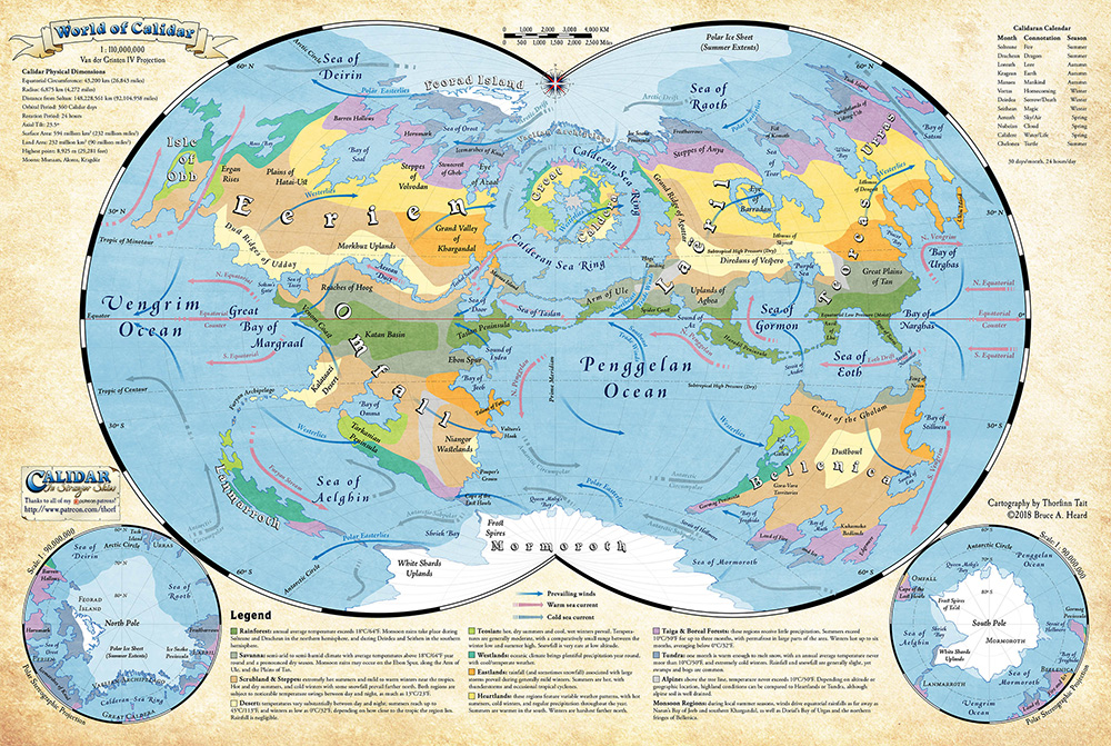
World of Calidar

©2018 Bruce A. Heard. World of Calidar™ Fantasy Setting.

I managed to complete the first assignment with just those tools, but as soon as I got my first commission, I invested it right back into my maps by purchasing MAPublisher and Geographic Imager.” With MAPublisher, a plug-in for Adobe Illustrator and Geographic Imager, a plug-in for Adobe Photoshop, Tait could work natively in both Illustrator and Photoshop.

“My favourite aspect of MAPublisher is without a doubt the custom coordinate system. It allows me to create resources for fantasy worlds just like they already exist for the real world, and then repurpose them across all of my maps,” says Tait. He also uses MAP Attributes and adds data to the world’s geography. “For example, it’s easy for me to track things like road and river lengths, land areas, dimensions of coastlines and political borders, and so on — MAPublisher calculates all of these things for me automatically.”

MAPublisher has allowed Tait to take his previous work and convert it to the newly established custom coordinate systems, without losing any of the GIS attributes he’d created over previous years. Tait also uses Geographic Imager to create Digital Elevation Models (DEMs) for the World of Calidar. DEMs can help bring maps to life, adding an intricate level of detail and depth.

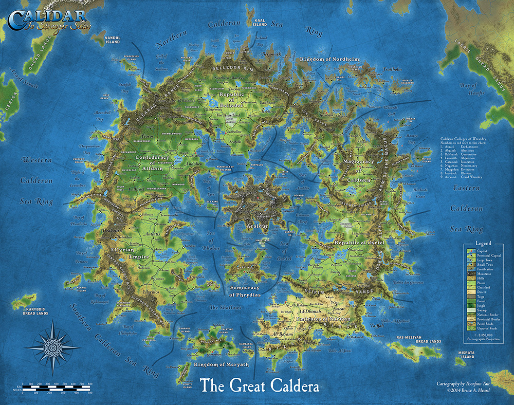
World of Calidar

©2014 Bruce A. Heard. World of Calidar™ Fantasy Setting.

Tait’s tagline for his freelance business is “Mapping fantastic worlds with real-world accuracy”. “I couldn’t do this without MAPublisher and Geographic Imager,” he says. “The software allows me to create and work with data for a fantasy world just like other people map the real world, the only difference is that I am creating all the data myself!”

“MAPublisher has truly expanded my horizons as a cartographer and has also changed the course of my projects. Without it, my current work would simply not be practical — in fact, probably not possible at all.”

Tait is currently working on georeferencing existing Mystara maps and tagging elements with their original sources. Check out more of his mapping projects on his website!

Cartographer Chronicles: Alison DeGraff Ollivierre

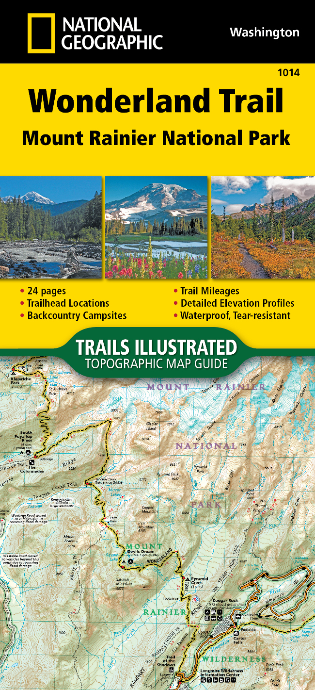
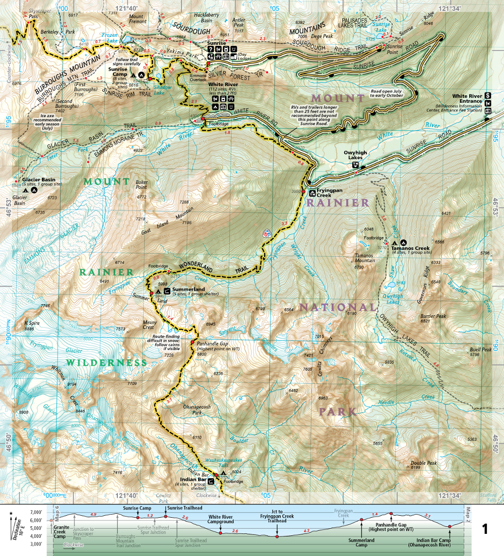
Alison DeGraff Ollivierre caught the geo/carto-bug from an introductory geography course in her first semester at Middlebury College, quickly realizing that the discipline was the perfect combination of her diverse interests in global affairs, conservation, history, and sociology. Now a cartographer at National Geographic Maps, Ollivierre works on the Trails Illustrated topographic outdoor recreation map products from an office in Colorado, making it easy for her to always be planning her next hike or trip to a National Park.

Ollivierre began her professional career as a Geography Intern at National Geographic in 2011, working with NatGeo Live and the Giant Traveling Maps. During her internship, she had the opportunity to make maps for a few NatGeo Explorer lectures and Giant Traveling Map fact cards, but what really stuck with her was how the incredible breadth of geography was used every day at NatGeo (and meeting Sylvia Earle—she thought that was pretty cool!). Since then she has gone on to win multiple awards for her cartography and was recently recognized by xyHt Magazine as a 40 Under 40 Remarkable Geospatial Professional for 2018.


As a certified GIS Professional, with a master’s degree in Geoinformatics from the University of the West Indies, Ollivierre knows geospatial data and how to handle it but also understands that—while the data is important—there is more that goes into making a good map than just the data. ‘I believe strongly in the importance of great design.’ explains Ollivierre. ‘It has the power to make geospatial data more engaging, interesting, and accessible to its audience.’

Ollivierre started using MAPublisher—a cartography plug-in for Adobe Illustrator—in 2016 when she returned to work at NatGeo after facilitating a participatory mapping project in the Eastern Caribbean, working as a cartographer and GIS specialist in Maine, and conducting freelance cartographic work for organizations across the globe. ‘I had played briefly around with a trial version of MAPublisher before that and heard a lot of great things about the software, so I was excited to learn how to use it at NatGeo Maps.’ says Ollivierre. ‘We complete 99% of our daily tasks in Illustrator + MAPublisher so its power is clearly evident in our workflow.’

Making quality maps that bring to life complex geospatial data requires a mix of science, art, and specialized tools to get it right. ‘I love the process of turning raw data into a map that clearly (and attractively!) gets its point across.’ says Ollivierre. ‘For me, MAPublisher is the obvious choice to bridge that gap between GIS and cartography.’

Find Alison on LinkedIn

Cartographer Chronicles: Mirian Isabel Say

Cartographer Chronicles - Mirian Isabel Say

Brazilian-based cartographer, Mirian Isabel Say, has two passions: making maps and traveling. Lucky enough to live in a large, diverse, and beautiful country as Brazil, she has extensively traveled through it to gain inspiration for personal growth and to find influences for her map designs. As an idealist, Mirian considers maps as works of art, not merely used to perform a singular function. Especially in a natural resource-rich country like Brazil, she believes that maps can help change the lives of its users, transcending the use of maps from a purely commercial purpose to a purpose that is appreciated and acknowledged.

For Mirian, the map design process is a huge personal journey, and having the right tools can be the difference between a published map and a map left unfinished on the computer. When Mirian began her cartography career in 1992, her choice of existing graphic design software was limited and didn’t include suitable tools specific to mapping. Even as the software improved, it didn’t support any of the commonly used geographic data file formats and she was limited to importing data that was not spatially referenced. For example, to accurately create a map scale by hand is very complicated—as any well-trained cartographer knows—and the functionality to do it digitally wasn’t available. Exporting to other cartography formats was not feasible since maps were not georeferenced. Symbols and labels were placed individually, often taking many hours of labour.

By 2004, graphic design and GIS software had become more advanced. Mirian learned about MAPublisher in-person at a GIS and mapping trade show and immediately liked how the many cartography and GIS tools were seamlessly integrated into Adobe Illustrator. She believed she finally found a cartography product that would be an all-in solution. When she returned home, she continued working in her existing graphic design environment, but continued to experience the many shortfalls of it. After some careful planning, she decided to take the leap and jump in headfirst to acquire MAPublisher and Adobe Illustrator.

Any major changes to a workflow including one that involves new software can be difficult at the beginning. Mirian began to adapt from her older graphic design software and learned the new MAPublisher toolsets through Avenza resources and working with the Avenza Support team directly with questions about workflows and best practices. “My type of work is not very common in Brazil and there are few engineers and cartographers who do it. Many years ago, I received professional critiques that my maps were beautiful but not accurate enough. Today, I’m very glad to say that I can create maps just as beautifully and more importantly keep them accurate.”

Vulnerabilidade      SJDR

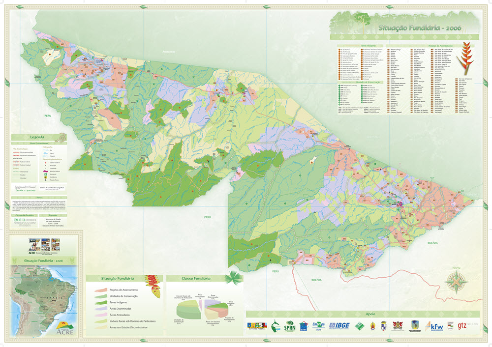
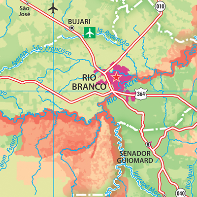
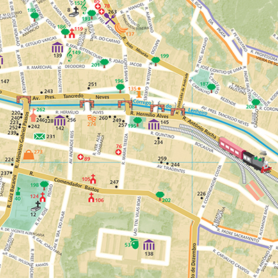
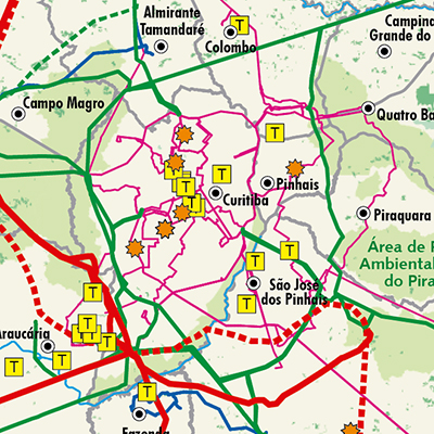
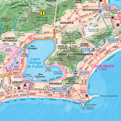
Mirian’s style of mapping is an immersive experience. When hired to produce indigenous and environmental maps for the Brazilian state of Acre government, she researched the region’s geography, read about its natural resources, and made a trip to visit to explore the culture, people, and food. She says she hopes that others can also see the human side of geographic space as she portrays it in her maps and that maps can provide not just information, but social change. She believes that her connection to and experiences of places make her a better cartographer. When she created the official tourism map for the City of Rio de Janeiro, her home city, she wanted to be “in the present” and decided to explore areas of the city intimately by foot to visit museums, beaches, and landmarks. The City also helped her understand the scale of the area by helicopter – a definite highlight in her career. The result was an appreciation of the city’s colour palette expressed on her map. “The sea was light blue, the green forests were intense, and the rock formations were magnificent. Rio de Janeiro is a very sunny and cheerful city so I used cheerful yellowish-green colors.”


Mirian continues to produce maps for many clients and has had her maps featured in several publications. She has also taught several post-graduate cartography courses at universities and lectures on cartography techniques and the importance of using the best cartography tools available.


Cartographer Chronicles: Mike Boruta

Colorado-based cartographer Mike Boruta knows a thing or two about making maps. In fact, this award-winning cartographer has been designing spectacular maps and trail guides for more than a decade. His work can be seen in the National Geographic Trails Illustrated series, in mountain biking guides released by Fixed Pin Publishing, fly-fishing reference maps curated by Stonefly Press, or most recently in the hiking trails guide for the mountainous town of Ouray, Colorado, where he currently lives. Always fascinated with viewing the world from above, Boruta has dedicated his career to capturing the beauty of mountain landscapes through well-designed maps, and captivating cartographic styles.

Following several years of post-university travel, Boruta found himself living in the tiny tourist-driven town of Ouray. Seeking more opportunities for career advancement, he moved to Arcata, located on the north-western coast of California. He considered returning to school to pursue a computer science degree but realized the subject matter did not entirely excite him. That was when a coworker of his first told him about the excellent Geography and Cartography programs at Humboldt State University nearby. He learned about a subject-stream called Geographic Information Systems (GIS), and although having never heard of GIS before, the concept immediately interested him. His years of travel had given him quite an appreciation for maps, and the GIS and Cartography programs at HSU would allow him to combine this appreciation with an interest in computer technology. 

He quickly developed a passion for cartography and decided to pursue graduate schooling in Athens (OH), where he studied under established cartographer Dr. Margaret Pearce. Forever drawn back to the rugged mountain landscapes where he had lived in the past, Boruta found a particular interest in studying relief representation in cartography, the technique used to create the illusion of 3D-terrain on a 2D map. He fell in love with the work of renowned Austrian cartographer Heinrich Berann, whose painterly style “birdseye” mountain maps continue to inspire him today.

 “Anytime I had to choose a place to use for projects in my cartography or GIS classes I found myself pulled back West, usually to Ouray, Colorado. I grew increasingly interested in mapping mountainous places”

In 2009, Mike Boruta first began using Avenza MAPublisher in his work. He had recently won the Arthur Robinson Award for Best Printed Map, part of the CaGIS Map Design Competition, for his entry “The Million Dollar Highway”, which explored a scenic stretch of road connecting Ouray to Silverton, Colorado. The award included a student license for Avenza MAPublisher software and allowed him to seamlessly integrate its suite of cartography tools into his already Adobe Illustrator-heavy mapping workflows. Shortly after, he began working with the publishing company Fixed Pin to create a mountain-biking guidebook for the entire state of Colorado. The project was extensive and would require the creation of several complete and detailed map sets, each describing a unique part of the state. Recognizing the vast scale of work ahead of him, Boruta sought out mapping solutions that would help him enhance the efficiency of his cartographic workflow. 

 “This was the first time I really got to work with MAPublisher, and it was a joy to learn and to use. I immediately found out how useful it was to set up all my graphic styles and character styles since I was having to create 118 maps with the same look and feel.” 

As Boruta found himself less and less dependent on dedicated GIS software, he opted to focus on completing his projects from start to finish directly in Adobe Illustrator using the many data import and manipulation tools of MAPublisher. This environment, he felt, “lent itself to so much more creativity”. Integrating these mapping tools into his workflow also meant he did not have to continuously replicate shared design features between each map, instead organizing and stylizing his data into a series of 15 “master maps” and using the MAPublisher Vector Crop tool to create separate individual maps for specific regions. 

By 2011, Boruta had begun contract work with National Geographic to help produce maps for the Trails Illustrated line of topographic map products. Incredibly, in 2013 things aligned in such a way that he was able to once again move back to Ouray, the mountain-town he had fallen in love with many years earlier. There, he began meeting with the volunteer-run Ouray Trail Group (OTG) to discuss how he could help them improve their existing trail map, which is a major source of funding for the non-profit group. The first project was getting their map into the Avenza Map Store so that hikers could use the map on their phones and tablets. After that, it was clear that the newly created and extremely popular hiking route called the “Ouray Perimeter Trail” needed its own high-quality map. 

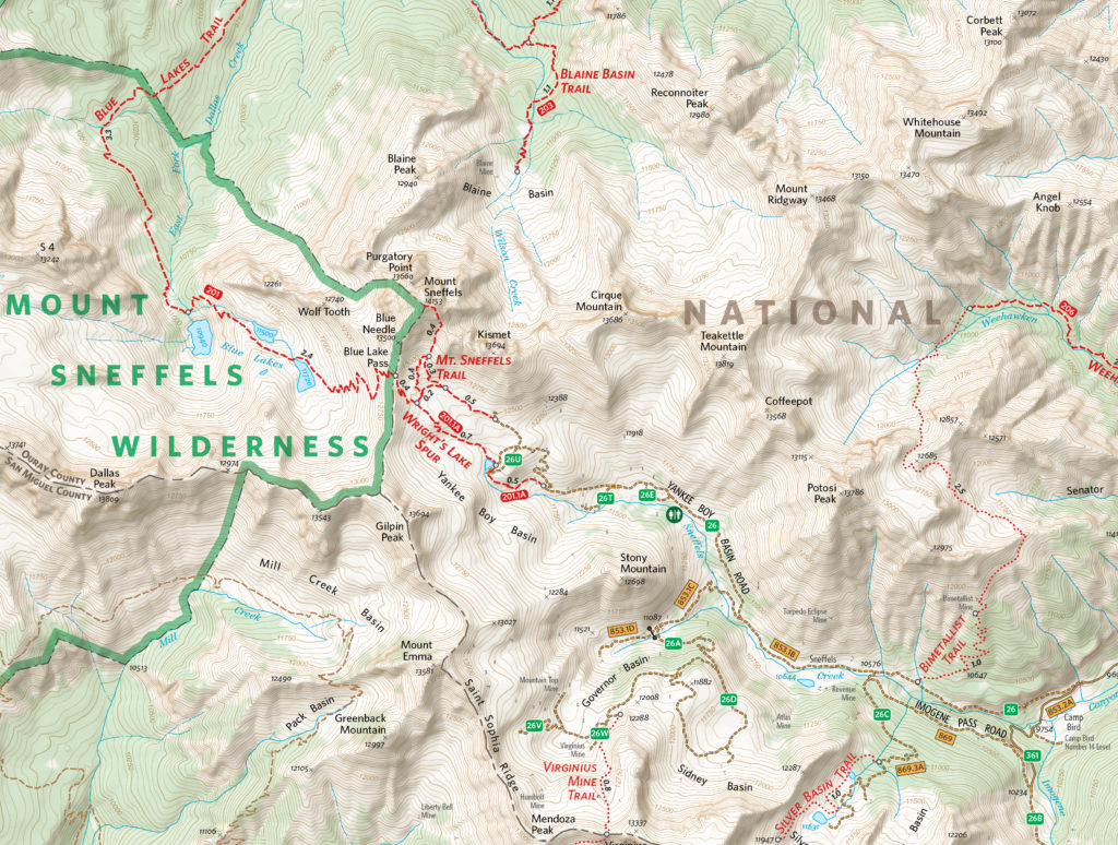
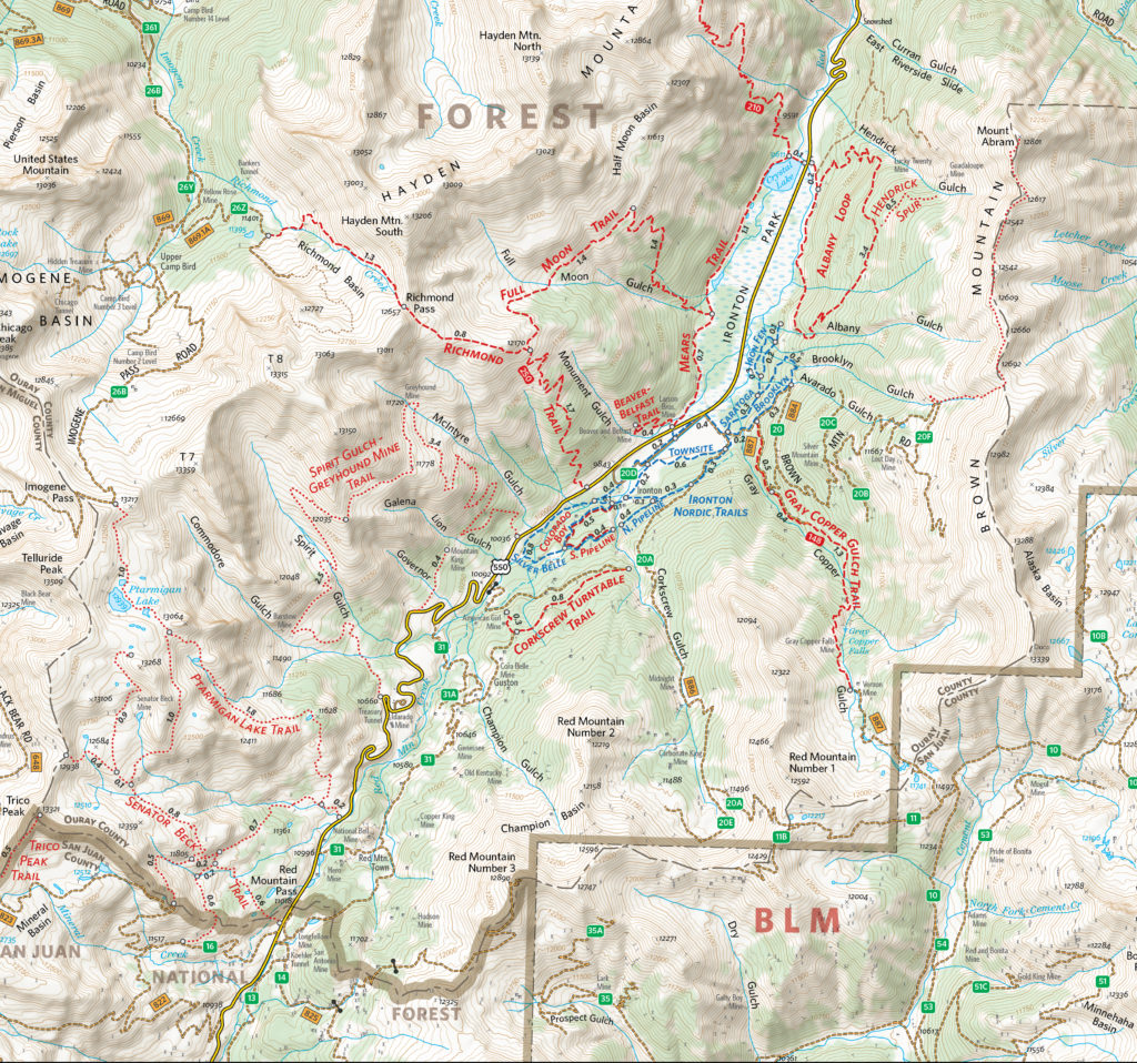
Finding some free time in the summer of 2020, Boruta dedicated himself to fully revising the Ouray Trail Group’s main trail map and also creating an all-new map for the Ouray Perimeter Trail. His vision included a highly-detailed, topographic map showing the entirety of the county’s vast trail system. He set to work collecting datasets and planning the map production, first using dedicated GIS software, before reverting to a more design-focused workflow in Illustrator. 

“I quickly moved things into Illustrator and MAPublisher and never looked back. There are certain tasks I’ve grown used to doing in MAPublisher that I just find so much faster and simpler to do than if I were in ArcGIS or QGIS”. 

As is common with many mapping workflows, working from mixed data sources can be a constant challenge for many cartographers, especially when data from different public agencies do not share the same projection and coordinate systems. Boruta found this to be a common occurrence while working on his OTG trail maps and highlighted his fondness for being able to drag and drop data into different Map Views directly within Illustrator. In this way, he allowed the software to automatically reproject datasets to a shared projection without having to open up any sort of tool or repeatedly configure data parameters. 

Boruta also emphasized how powerful the Vector Crop tools and “spatial filter on import” capabilities were, allowing him to quickly specify or delineate a region of interest and immediately crop all data layers to that area, retaining topology and attribute integrity, all within the Illustrator environment. When handling the reference maps used to guide the creation of the OTG trail maps, he implemented the Georeferencing tools in the Avenza Geographic Imager plug-in for Adobe Photoshop to efficiently georeference and georectify unprojected reference map images before integrating them back into his Illustrator project. After a large chunk of the summer working on the map, he delivered the finished trail map. On completing the project, he noted “It was one of the most satisfying projects I’ve ever worked on since I was literally mapping my own beloved backyard.”

The completed Hiking Trails of Ouray County and the Uncompahgre Wilderness map is available in printed form, and users can also purchase digital forms of that map and the new Ouray Perimeter Trail Map in the Avenza Map Store. The digital maps are fully geo-enabled and support offline use for navigation and GPS-location on mobile devices using the Avenza Maps app. 

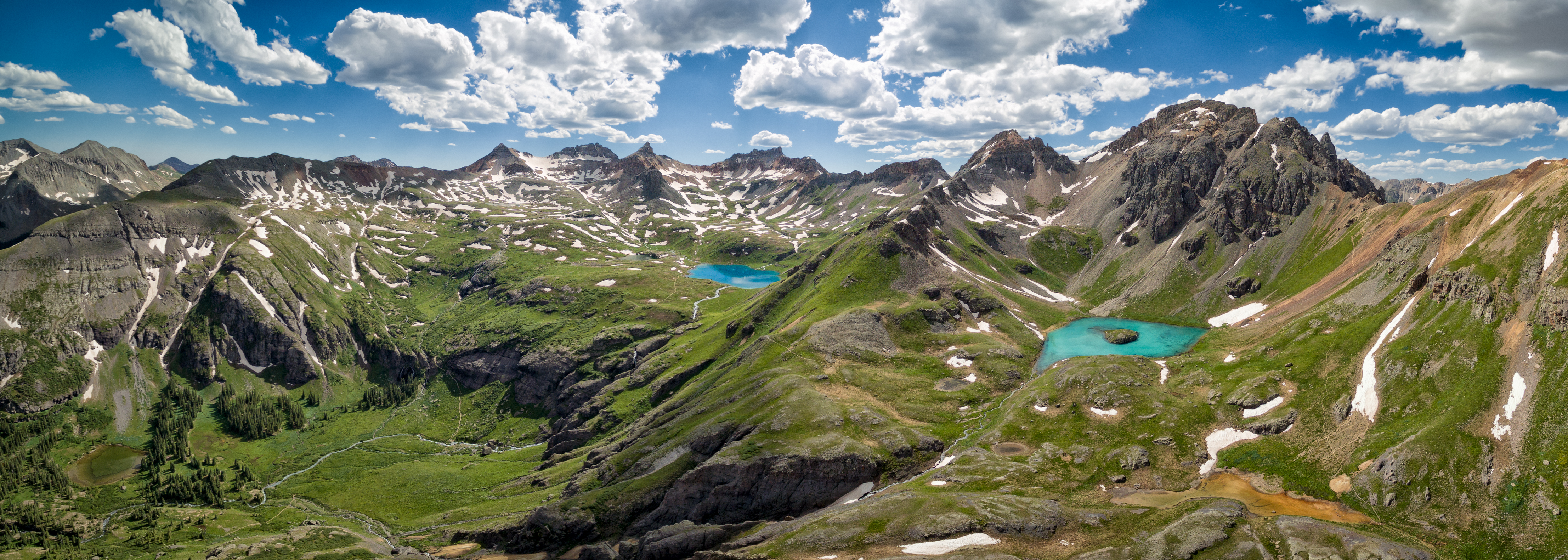
Mike Boruta still lives in his beloved town of Ouray. He spends his free time enjoying the trails and mountains which he has helped to map. He continues his work for National Geographic and has branched out his interests to include drone photography and videography. He operates the website OuraybyFlight.com, which showcases some of his spectacular drone photography work. His dream is to combine these dramatic landscape panoramas with overlaid symbols and text to create those iconic “birdseye” mountain maps that inspired him years ago. 

“I envision something that would hopefully be more aesthetically pleasing, something that aims to capture the soul of these San Juan Mountains while also illustrating the geography. And just maybe it might also be something pretty enough to hang on the wall.”

News Archive