For the majority of Avenza Maps users, layers are indispensable. Not only are layers a repository where placemarks, tracks, and photos are stored, but they also enable you to both manage and share map feature data.
With the release of Avenza Maps 3.5, Android users will be introduced to a feature that was previously only available on the iOS platform, the Layers tab. The Layers tab is an invaluable resource which provides a complete listing of all layers in the app database, including their existing map associations. But what is most exciting about the Layers tab is it’s new ability to export layers. Exporting layers from the Layers tab will streamline data archiving. From the Layers tab, you now have the ability to export an individual layer, multiple, or all existing layers in one fell swoop.
Let’s see just how easy it is now to archive your map feature data.
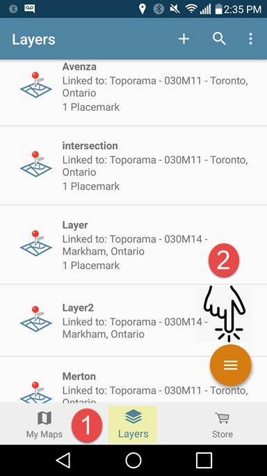
Say we had two topographic maps. One map contains two layers while the other has three separate layers. Below is an example of how all five layers can be exported from the Layers tab at once.
iOS
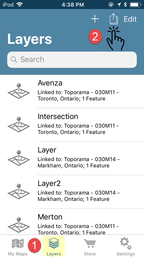
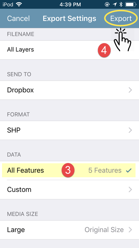
Android
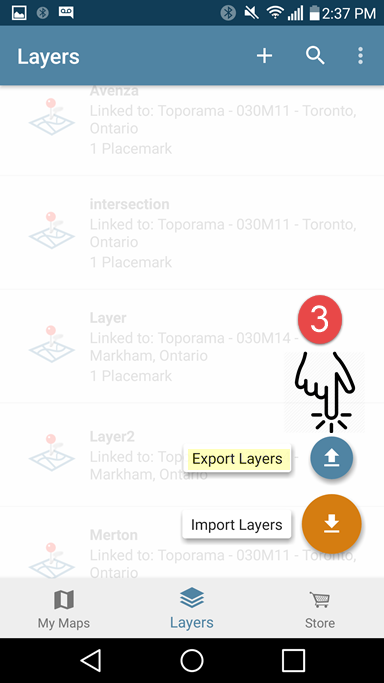
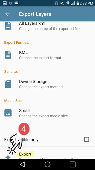
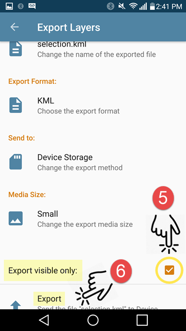
If you plan on importing your exported data back into the app, it is important that you export to either the KML or Shapefile (requires a Pro subscription) formats. Once you have tapped on Export, navigate to the storage location and tap Upload (iOS) or tap the check-mark icon (Android) to export. All of your layers will be exported to a single file for archiving. If you wish to restore these layers at a later date, you can simply import them back into the Layers tab and all layers will appear in the layers tab as they did prior to export.
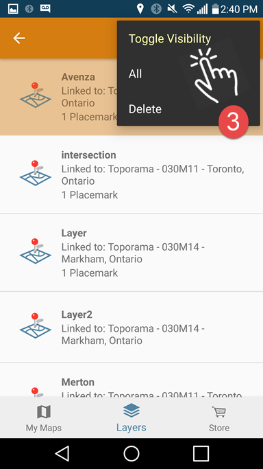
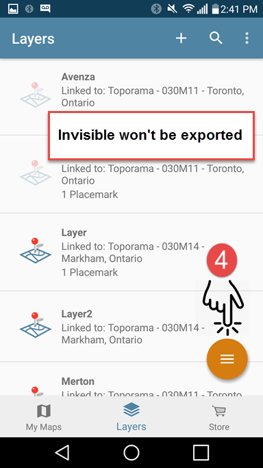
The following example is very similar but this time we are only exporting a selection of layers from the Layers tab.
iOS
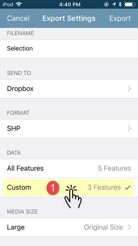
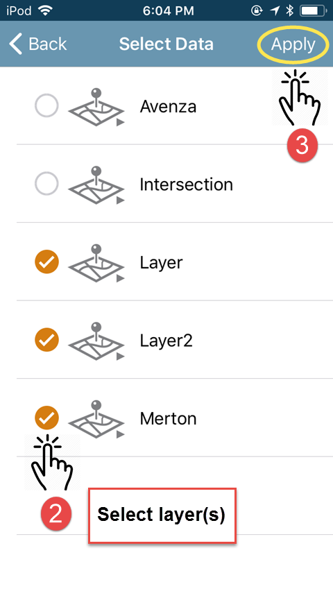
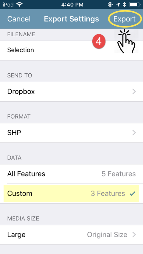
Android

When it comes to exporting map feature data from multiple maps, the Layers tab is now clearly the most efficient method. A word of caution, if you are exporting large amounts of map feature data, it is advised that you break your export up into separate files as opposed to saving all of your layers to a single file. If you are exporting to email, there are restrictions to the size allowed for file attachments. Additionally, when exporting large files, there are resource limitations that may come into play and which vary by device and work environment.
Your data is a valuable resource. Countless hours can be devoted to data collection and the resulting map features are vital to the completion of your work projects. For most, it is extremely important to regularly export data for backup or archiving. Exporting layers from the Layers tab has just made this process that much easier.


