In MAPublisher, the grid bound is the visual extent of the grid or graticule. The grid constraint is the geographic extent of the grid or graticule. It may be a little confusing since both grid bound and grid constraint are defined by coordinate values. In terms of hierarchy, think of the grid bound as the overall container of the grid and the constraint as being contained within the bound.
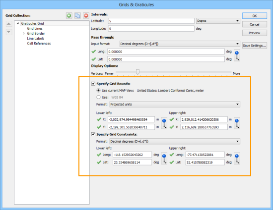
These examples may help you better understand it.
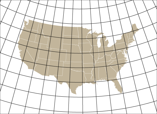
1. In this example, the grid bounds are specified as the lower-left and upper-right of the artboard corners. Notice that the graticule extends all the way to the edge of the artboard (as specified). This is a very typical way to use a grid or graticule.
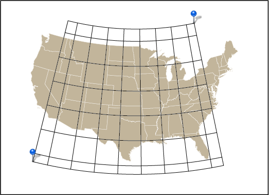
2. Here, the grid bounds are still the lower-left and upper-right of the artboard. The grid constraint is based on the minimum and maximum longitude and latitude values of the specified MAP Locations. Notice that the rectangular black border of the grid bound is at the edge of the artboard. This is also a common way to use a grid or graticule, especially for larger scale maps.
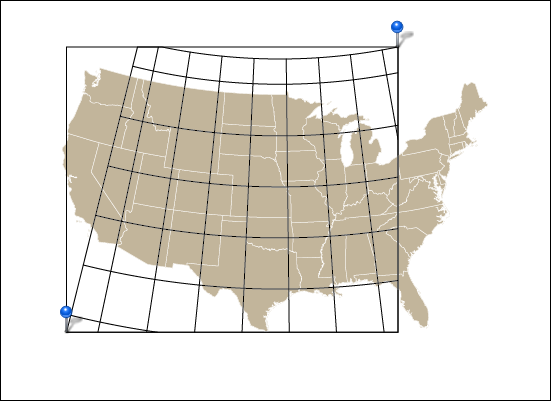
3. In this example, the grid constraints were disabled and, instead, the two MAP Locations are used to define the grid bounds. Notice that the rectangular black border of the grid bound is defined by two MAP Locations.
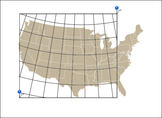
4. When both grid bound and grid constraint are set to the same coordinates (in this case, MAP Locations) you can see the result here. The grid bounds are clipping the grid constraints. This would not be an ideal situation to use grid constraints, but it is definitely possible to use it in this fashion.
MAPublisher Grids & Graticules are highly customizable and we’ll be blogging more about its features.


