Edit: Updated with a new QGIS workflow (November 21, 2014)
The following tip is courtesy of Hans van der Maarel of Red Geographics.
————-
For many areas on Earth, OpenStreetMap is a viable alternative to commercially offered data sources. However, it is not always easy to process. This blog tutorial explains the steps needed to load OpenStreetMap data into MAPublisher.
1. Download and install QGIS, this is a free GIS application, available for Windows, Mac and Linux computers. QGIS now comes with built in tools for downloading Open Street Map Data.
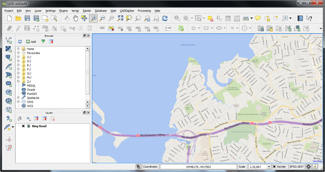
2. Open QGIS and zoom in to an area of interest. Use the OpenLayers plugin for a basemap if you do not have any imagery or mapping of your own. Keep in mind that downloads from the OpenStreetMap website are limited in the number of exported objects, so for larger areas you will have to combine multiple downloads yourself, or look for other options (for example Geofabrik).
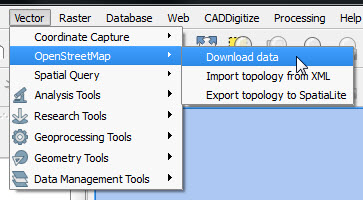
3a. Go to the Vector Menu and Choose OpenStreetMap and then Download data.
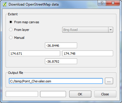
3b. Choose how you want the extent of the downloaded data to be defined. The easiest way is to use the Map Canvas.
4. Open your downloaded .osm file in QGis using the Add Vector Layer tool. Select all the Layers and choose OK.
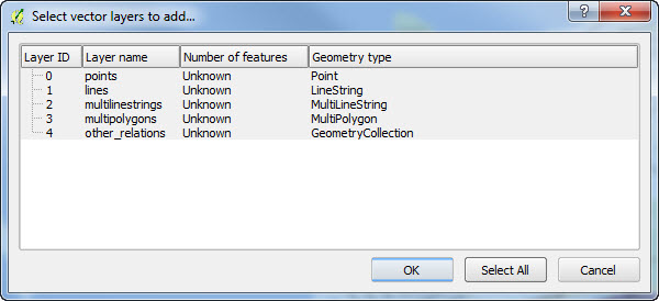
This results are shown in several layers depending upon what is present in the extent you have downloaded. In this case there are points, lines, multilinestrings and multipolygons. Note that QGIS only imports features that fall completely within the extent specified. So make sure you choose an area larger than your actual area of interest to ensure it is completely covered.
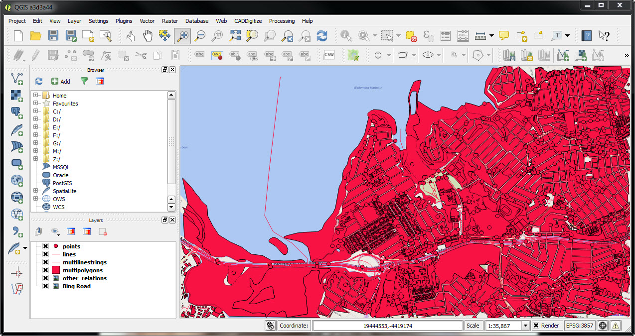
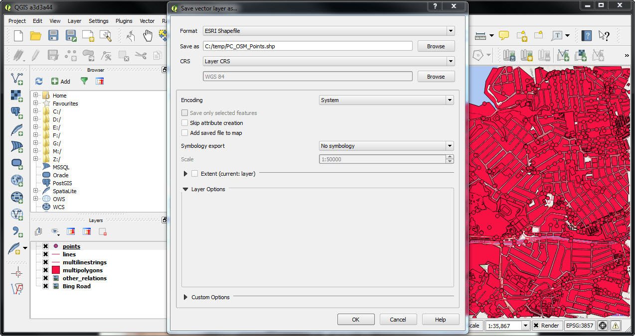
5. Export these layers one by one. Right-click and choose “Save As, then ESRI shapefile”.
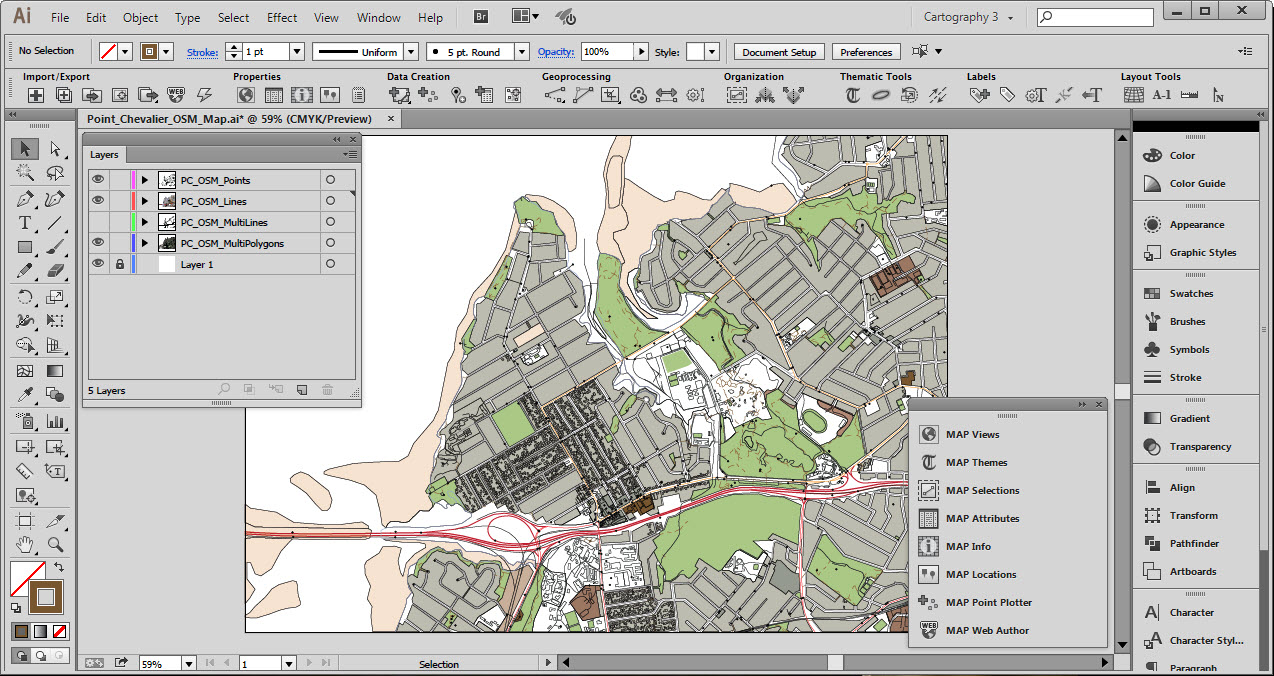
6. The shapefiles can be imported into Adobe Illustrator using MAPublisher. After reprojecting, scaling and cropping we’ve ended up with the raw OpenStreetMap vectors in Adobe Illustrator, with all attributes still maintained.
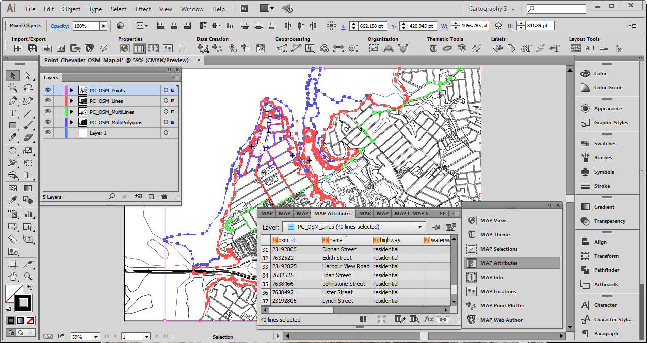
7. Once within the data is imported successfully, you may now use any of the MAPublisher and Adobe Illustrator tools to style and customize the map in any way you want.
