In this post, we’ll cover how simple it is to import a geodatabase feature class into Adobe Illustrator using MAPublisher import tools enabled with the Spatial Database add-on.

Spatial databases are optimized data repositories for spatial data storage and management. Many GIS environments use spatial databases to easily access and manage GIS data in a central location.
MAPublisher 8.2 introduces support for import of the popular ESRI single-user and multi-user Geodatabases: Personal, File and ArcSDE Geodatabases; and direct access to ArcSDE server. The MAPublisher Spatial Database importer is built on ESRI software libraries and requires a valid ESRI software and license installed on the computer (ArcGIS 9.2 and higher).
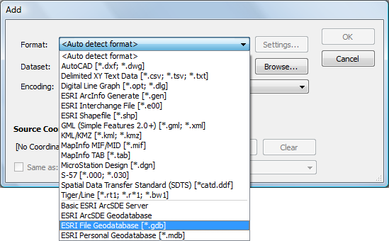
To import one, you can use either Simple Import or Advanced Import. In this scenario, we’ll use Advanced Import. When we add data, a list of Geodatabase types are located at the bottom of the Format list. We’ll be importing some feature classes from a simple geodatabase consisting of waterlines, hydrants and valves.

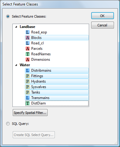
After browsing for the geodatabase (a File geodatabase in this case), the Select Feature Classes dialog box appears. We’ll go ahead and select a few feature classes from the Landbase and Water feature sets listed.

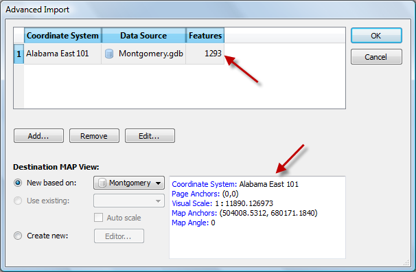
The Advanced Import dialog box shows the number of features being imported and the coordinate system as well as page and map anchors.

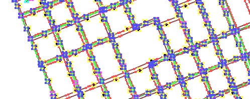
The features are imported and are ready to be used in a map.


