We released an update today, to MAPublisher, our well-known cartography plug-in for Adobe Illustrator. This version features support for the Equal Earth projection, has a new look and feel that more closely matches Adobe Illustrator’s interface and includes new options for importing geospatial data into Illustrator.
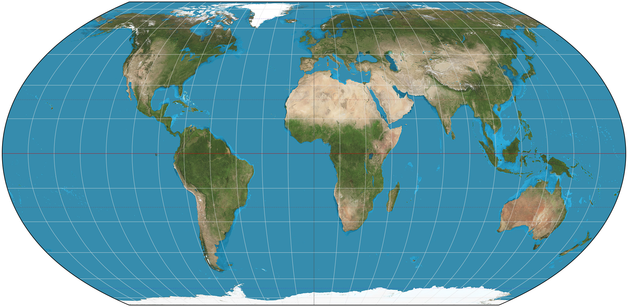
Equal Earth Projection
An Equal Earth World Map

By Strebe – Own work, CC BY-SA 4.0, https://commons.wikimedia.org/w/index.php?curid=72769307
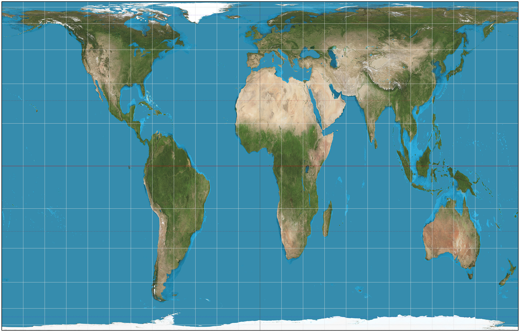
A Gall-Peters World Map

By Strebe – Own work, CC BY-SA 3.0, https://commons.wikimedia.org/w/index.php?curid=16115242

Want an Equal Earth map to experiment with? You can download MAPublisher-enabled Adobe Illustrator files at equal-earth.com
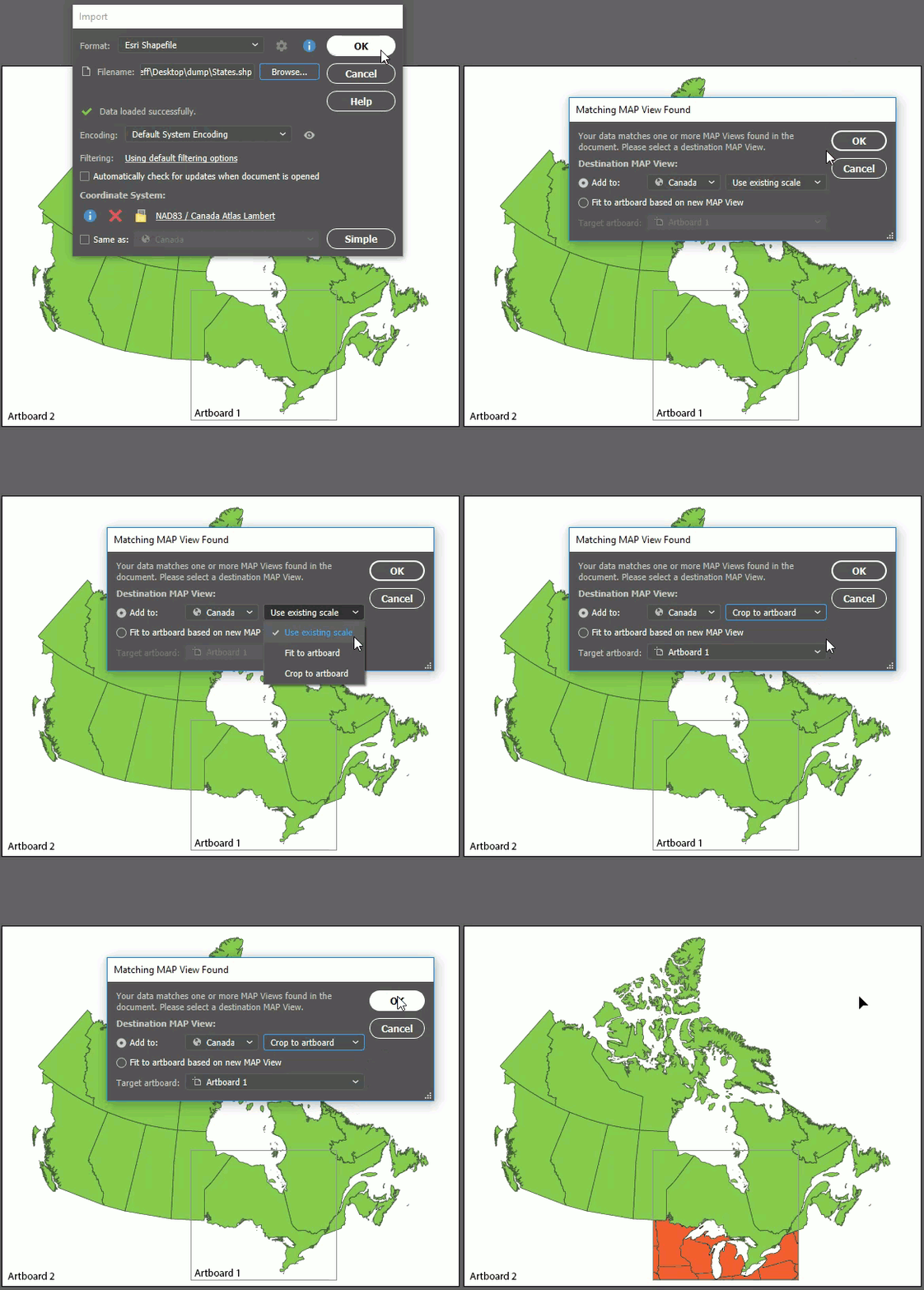
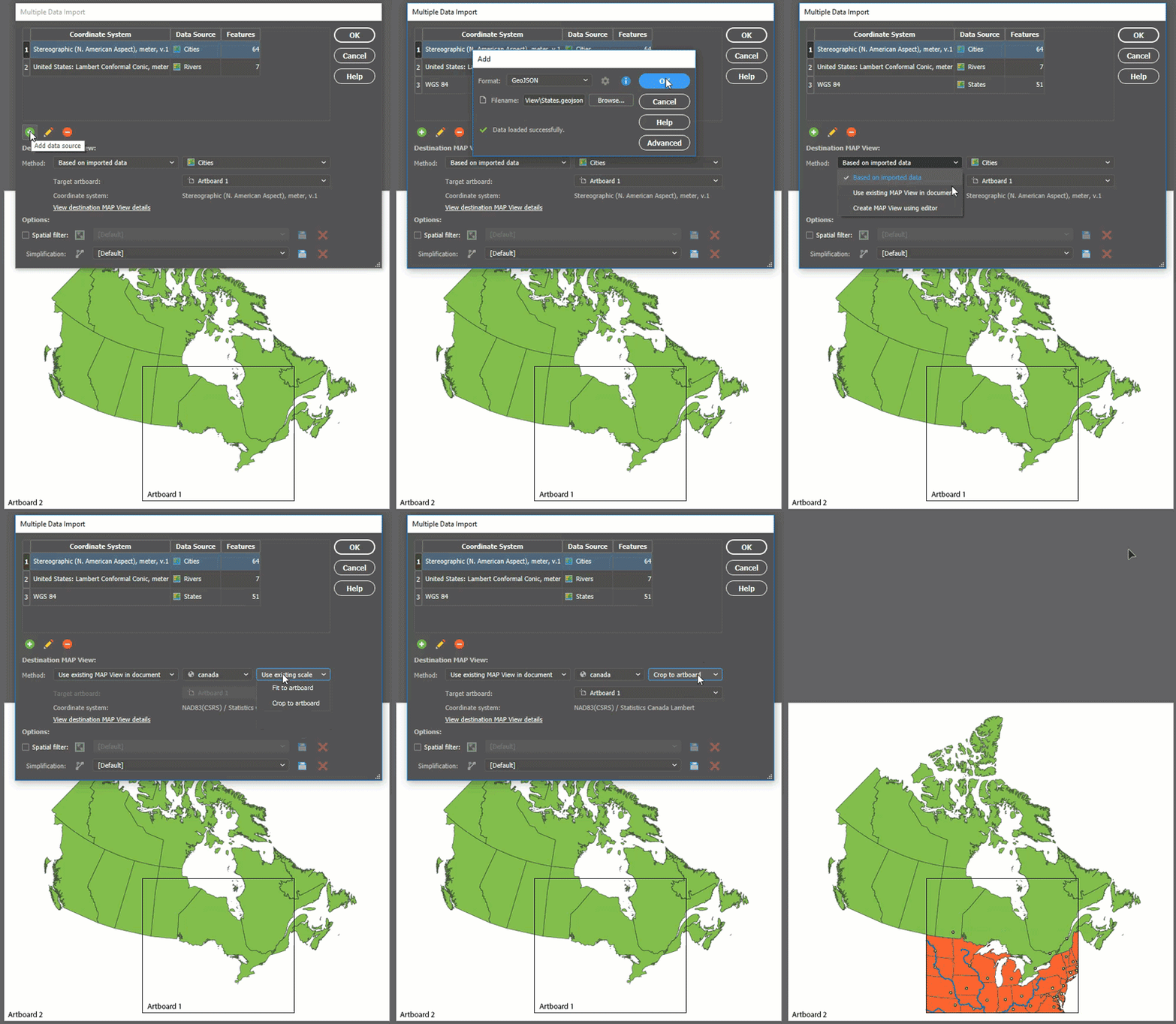
Crop to Artboard
In MAPublisher 10.4, when a matching MAP View is found while using the Import or Copy MAP Objects From tools, you can now choose to crop the added data to an artboard’s extents. This same functionality is available when specifying the destination MAP View in Multiple Data Import. Furthermore, if you don’t want to add data to the existing MAP View, you now have the option to specify which artboard the incoming data will be added to.


New Look
We’ve changed the look of the MAPublisher tools and dialogs to match the colours, fonts, and styles of the Adobe Illustrator interface. So as you use the MAPublisher tools, it feels more like you are still using Illustrator – which of course, you are! The MAPublisher tool and dialog styles will also change to match any changes in the Illustrator interface preferences. Note that the interface changes only apply to Adobe Creative Cloud versions of Illustrator, not CS6.

MAPublisher 10.4 Release Notes
- Support for Equal Earth projection
- New options available to auto-crop data when importing or copying MAP objects
- Enhanced user interface matching Adobe Illustrator interface preferences
- Various user interface and usability enhancements


