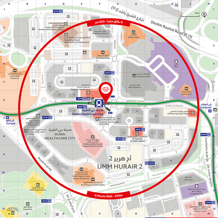
Dubai Healthcare City Metro Station
Zain Madathil
Explorer Publishing, Dubai
This map represents one of over 4000 individual maps for the Dubai Public Transport Map project. The map provides users with an easy-to-use and informative platform map. The map is multi-language, providing information in both English and Arabic, and is accompanied by a detailed map index to categorize and highlight important points of interest and nearby attractions surrounding the station.
The map utilizes careful design elements to improve interpretability, including color-coded icons and building footprints,, platform-based direction markers, and a 500m radius walking distance indicator.
Learn more about this map in its Map Spotlight blog.


