We are thrilled to announce the release of MAPublisher version 11.4, the newest version of our MAPublisher extension for Adobe Illustrator.
MAPublisher v11.4 introduces a newly reworked Create Knockouts tool, importing Vector Basemaps within a selected area, WMS 1.3.0 import support, a new Rotate Characters text utility, a preference to convert RGB black to 100K black in CMYK documents, setting a leader line offset with the MAP Tagger tool, and several performance updates and bug fixes.
Here’s what you can expect with the latest MAPublisher v11.4 release:
The Create Knockouts tool has a new design!
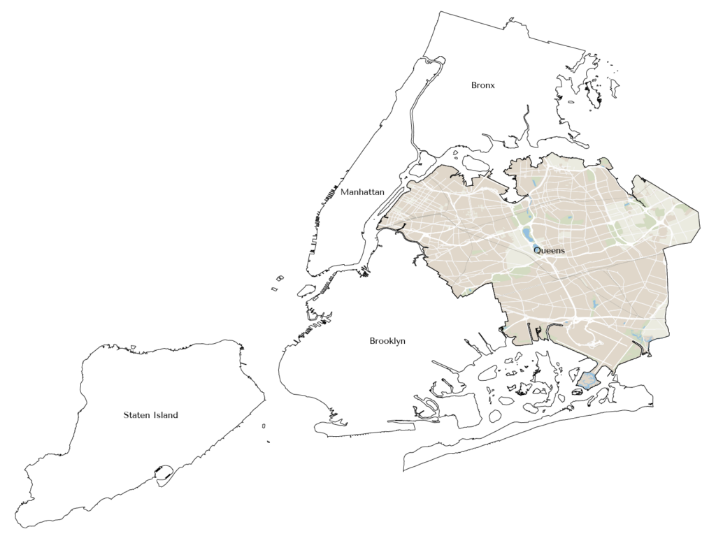
We are excited to introduce you to the new version of the Create Knockouts tool. Create Knockouts is a tool that allows you mask off parts of features that may be covered by things such as text or points. The aim of this tool is to increase the readability of your map, especially in areas where features may overlap or look cluttered.
The previous version of the Create Knockouts tool only consisted of a single dialog box. This had the limitation of allowing knockouts to be created around only a single layer at a time, meaning that multiple iterations of the tool had to be run to create knockouts for several different layers. This also meant that correcting mistakes or modifying existing knockouts required the tool to be run again, which could be frustrating or time consuming.
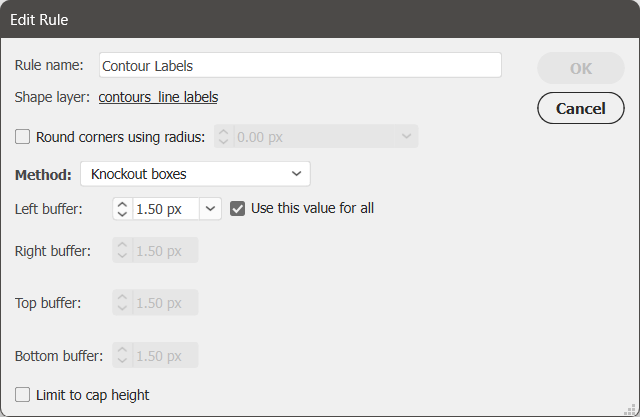
The new version of the Create Knockouts tool features an improved tool architecture which introduces knockout settings stored as jobs and rules. Jobs and rules allow knockouts to be created simultaneously for multiple layers.
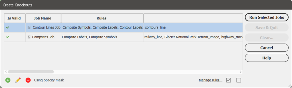
A job defines which layers are being masked and consists of one or more rules that will be used to form the knockouts.
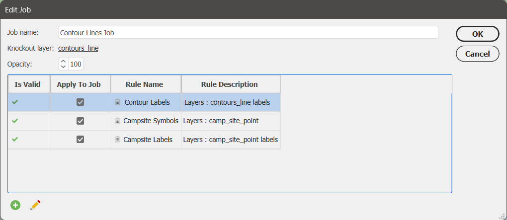
A rule defines the overall appearance of the knockouts and which layers the knockouts will be formed around.
One very useful thing about jobs and rules is that they are also transferable to your other map documents through the use of the Copy MAP Objects From tool.
The introduction of jobs and rules to the Create Knockouts tool makes it much easier for you to create multiple batches of knockouts at once while also being able to save their settings. This is very convenient if you come back later and wish to make modifications to your knockouts as your map evolves through its creation.
To learn more about how the new edition of the Create Knockouts tool works, check out its support page or watch the video below:
Import Vector Basemaps within a selected area
The Vector Basemaps tool is also receiving a small but significant update in MAPublisher v11.4: you can now import basemap data to your document only in a specific area! This option is available in the Import Vector Basemaps dialog box by way of selecting the “Only import data within the selected area” checkbox when you are selecting data for an existing MAP View. However, for this checkbox to be selectable it does require the following conditions to be met:
- The selected area must be a single shape or compound path
- The selected area must be closed
- The selected area must not overlap itself
- The selected area must be located within the current MAP View
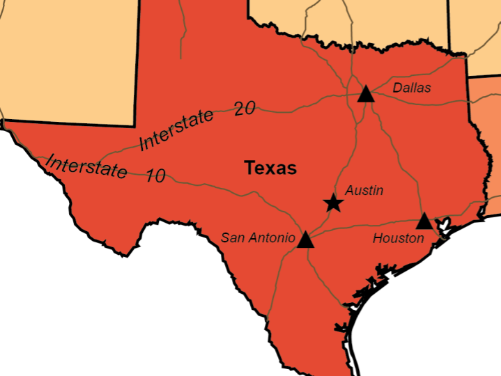
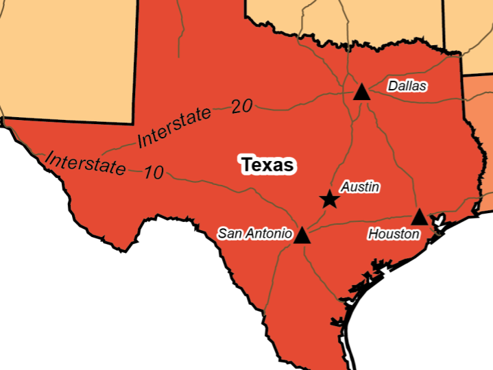
This new option for the Vector Basemaps tool is perfect for the quick creation of interestingly shaped inset maps!
Import data from WMS 1.3.0
Many of our users have requested the ability to be able to import data from Web Map Service (WMS) version 1.3.0 and we are happy to announce that this is now possible in MAPublisher v11.4! Simply follow the usual steps to add a web map service and select 1.3.0 from the Version drop-down menu. We have also added an “Autodetect Version” option in this menu which can detect the WMS version used by the URL provided.
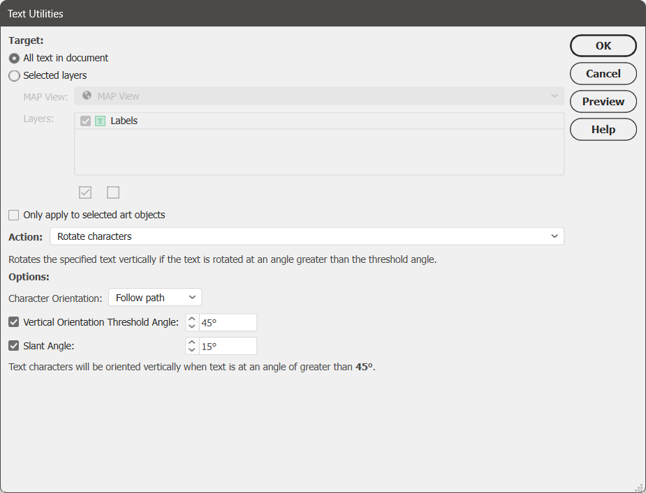
Rotate Characters action added to Text Utilities
Rotate Characters is a new option that has been added to the Action menu of the Text Utilities tool. This action only applies to point text, not text-on-a-path. It introduces the option to select whether your characters are oriented to follow the direction of the path, or point upwards. It also gives users the option to set a vertical orientation threshold angle, which determines which text elements will be rotated vertically, and/or set a slant angle, which will rotate characters within a text element.
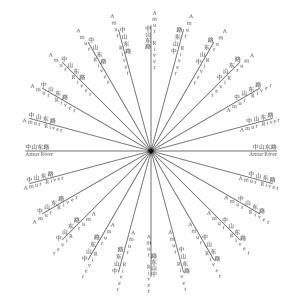
The Rotate Characters text utility action is a great way to increase readability of the text objects of a map and is especially useful for languages that require properly rotated characters to be more understandable, such as Chinese. Below is a basic illustration of the new feature.
Convert RGB black to 100K black upon import in CMYK mode
In CMYK documents, RGB black features are often converted to rich black (i.e. 4-colour black) instead of 100K black, which can cause an issue known as “ghosting” when printing features that require fine detail such as small text and lines. Ghosting is when tiny variations in the printing plate produce blurry remnants of the 4 colours around the edges, as seen below.
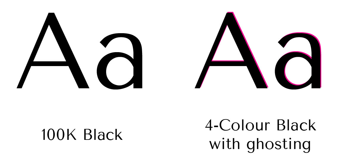
To help printed map-makers easily avoid ghosting, a new option has been added to MAPublisher Preferences in the Import Map Data section to “Convert RGB Black to 100K Black” for CMYK documents. This option will be enabled by default.
Specify a leader line offset when using MAP Tagger
When using the MAP Tagger tool, the option to specify an offset between the leader line and the feature has been added in the “Leader Line Settings” tab under the Rules section. Select the “Offset from feature” checkbox and set an offset distance. This can be used to ensure that the created leader line does not obscure the feature you are labeling.
MAPublisher 11.4 is Available Now!
If you would like to learn more about the new MAPublisher v11.4 features or have any questions, please check out our Support Centre.
MAPublisher v11.4 is immediately available today, free of charge to all current MAPublisher users with active maintenance subscriptions and as an upgrade for non-maintenance users.