My Account     Contact Us     Cart

Articles

Fixed vs. Floating Licenses: Which One is Right for You?

When purchasing Avenza desktop software, MAPublisher and Geographic Imager, you are able to choose between two main license types: a fixed license or a floating license. This blog will cover the primary differences between the two and hopefully help you determine which setup will work best for you!

Fixed License

Fixed licenses allow for the software to be used on only one computer. This is usually sufficient for most single users or small companies, even with just a few licenses. A fixed license is, as the name suggests, fixed to a specific computer. Consequently, this means that it generally cannot be moved freely to another machine, although Avenza does allow you to move your license occasionally. For example, if you have purchased a new computer or if your main computer is being repaired and you need to transfer your fixed license to another computer. This is called rehosting a license. A license rehost is free as long as you have active maintenance on your license, or can be done for a fee if your maintenance is not active or expired.

Floating License

Floating licenses allow an organization to deploy a specific number of licenses that can be used and shared on any number of computers over a network. This is a great solution for any company that has multiple users of MAPublisher or Geographic Imager, especially if all users have their own machine. As such, this means that floating licenses do not need to be rehosted, however there must be a central server from which the licenses are provided to the users within the network. Hence, floating licenses can be further broken down into two categories: cloud floating licenses or local floating licenses.

Cloud Floating License

Cloud floating licenses connect users to their license through the internet. This does not require any additional setup on the organization’s side, and users can access and manage their licenses and servers through a cloud-based customer portal.

Local Floating License

Local floating licenses require a systems administrator at the organization to set up a local server on a computer which meets certain specifications. Only users connected to the local server will be able to check out these licenses on their client computers.

Floating licenses are often the chosen option when an organization would like to share a number of licenses between members. For example, if an organization’s license server holds two seats of MAPublisher licenses, when users on Computer A and Computer B have each checked out MAPublisher licenses, other users on the network are not able to check out a license until the borrowed licenses are checked back in.
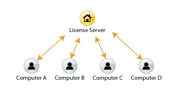
An example environment of a floating license system

Floating licenses also give users the ability to borrow a roaming license with their laptops. This is a good solution for users who want to temporarily use MAPublisher and Geographic Imager when they are not connected to the floating license server.

For more information about the licensing options for Avenza desktop products, please contact Avenza sales. For any technical questions about setting up a license server or any other licensing issues, please contact Avenza support.

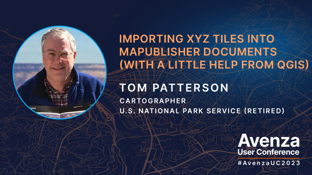
UC Spotlight: Importing XYZ Tiles into MAPublisher Documents

Many cartographers have faced this dilemma: your map needs an extra bit of vector information, such as a missing road, but adding it would involve finding, importing, and sifting through huge datasets. Tom Patterson joined us at Avenza UC 2023 to present an easier solution to this problem with the help of QGIS. Tom showed us a simple way to add satellite images and/or raster reference maps, available as XYZ tiles, to our documents in MAPublisher. The imported images will register with your map regardless of which projection it uses. You can then use these images to manually digitize the missing data on your map in just a few minutes. With a little back and forth between MAPublisher and QGIS, from where the XYZ tiles are exported, you can fill in the gaps in your cartographic data in no time!

Tom demonstrates in his presentation how he would use satellite data from Google or Bing to complete a portion of the coastline of southwestern Tasmania. This method is also how he makes updates to the Natural Earth datasets he maintains on his website.

Check out the video of Tom’s full presentation at the Avenza UC 2023!

About Avenza UC

The Avenza User Conference is an opportunity to discover exciting new developments with Avenza’s GIS and cartographic solutions and to connect with peers and Avenza team members. Avenza users and staffers from around the globe meet virtually each May to learn what’s new with Avenza Maps, MAPublisher, Geographic Imager, and the Avenza Map Store, and see how they are being used to map our world.

The Avenza User Conference is an free annual event that grows each year with incredible speakers and participants. Get inspired by mapping and industry professionals by joining us for #AvenzaUC2025. Find more information here about next year’s conference taking place on May 8th, 2025.

News Archive

Blog Archive

December 2024 (1)
November 2024 (1)
October 2024 (1)
November 2024 (1)
September 2024 (1)
August 2024 (2)
July 2024 (1)
September 2024 (1)
June 2024 (1)
July 2024 (1)
May 2024 (1)
April 2024 (2)
May 2024 (1)
March 2024 (2)
February 2024 (1)
January 2024 (1)
December 2023 (1)
November 2023 (2)
October 2023 (2)
September 2023 (1)
August 2023 (1)
July 2023 (3)
June 2023 (1)
February 2023 (1)
January 2023 (2)
December 2022 (1)
November 2022 (2)
October 2022 (2)
September 2022 (1)
May 2023 (1)
August 2022 (2)
July 2022 (1)
June 2022 (2)
May 2022 (1)
February 2022 (1)
January 2022 (2)
August 2022 (1)
December 2021 (3)
November 2021 (5)
October 2021 (1)
September 2021 (3)
August 2021 (2)
July 2021 (1)
June 2021 (2)
May 2021 (2)
April 2021 (2)
March 2021 (3)
April 2021 (1)
February 2021 (1)
January 2021 (1)
November 2020 (1)
October 2020 (1)
June 2020 (2)
May 2020 (1)
April 2020 (3)
March 2020 (2)
December 2019 (1)
November 2019 (2)
September 2019 (1)
August 2019 (1)
July 2019 (1)
June 2019 (3)
May 2019 (4)
April 2019 (2)
March 2019 (1)
February 2019 (2)
January 2019 (3)
December 2018 (2)
November 2018 (1)
October 2018 (1)
September 2018 (2)
August 2018 (4)
July 2018 (2)
June 2018 (1)
July 2018 (1)
June 2018 (4)
May 2018 (1)
April 2018 (2)
March 2018 (4)
February 2021 (1)
February 2018 (1)
January 2018 (1)
November 2017 (1)
October 2017 (2)
August 2017 (2)
July 2017 (1)
March 2017 (1)
February 2017 (2)
January 2017 (2)
November 2016 (1)
January 2017 (1)
November 2016 (1)
October 2016 (2)
May 2016 (1)
March 2018 (1)
April 2016 (2)
December 2015 (2)
June 2015 (1)
May 2015 (1)
April 2015 (2)
December 2014 (4)
October 2014 (2)
May 2014 (4)
February 2014 (1)
October 2013 (3)
April 2013 (1)
January 2013 (2)
August 2012 (1)
October 2012 (1)
July 2012 (3)
May 2012 (2)
January 2012 (2)
August 2011 (1)
July 2011 (2)
June 2011 (2)
May 2011 (2)
March 2011 (1)
February 2011 (1)
January 2011 (5)
December 2010 (1)
November 2010 (1)
December 2010 (1)
November 2010 (1)
October 2010 (1)
August 2010 (4)
July 2010 (2)
June 2010 (3)
May 2010 (2)
April 2010 (2)
March 2010 (2)