Have you ever had a point dataset where you wanted to obtain the elevation information for every point?
Instead of looking up another dataset to join elevation values or worse, looking them up by hand, MAPublisher 9.3 introduced a new feature to determine the elevation value for every point in a MAP Point layer using the “Add Calculate Data” tool. ![]() . This is based on using a GeoName account (more on this below).
. This is based on using a GeoName account (more on this below).
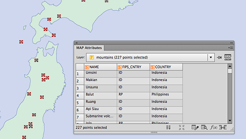
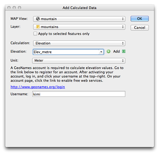
To use it, simply have a MAP Point layer imported to the artboard and open the Add Calculate Data dialog box. In this example, we’re trying to gather elevation points for mountains in Japan. In the Calculation drop-down list, choose Elevation. You can choose the units for the elevation value from the drop-down list. For this example, we are choosing “meter”. If you do not have the GeoName account yet, click the hyperlink and obtain one (for free). After you’ve registered for a GeoName account, enter your username and click “OK”.

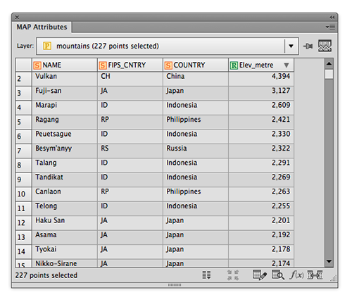
A new column “Elev_metre” is populated as specified in the Add Calculated Data dialog window and every point has the elevation information in meters.

This is a handy tool that may help when you have point data along hiking trails, ski courses, waypoints collected with PDF Maps (etc.) or when you need to find elevation data for any type of points.
If you use this feature, please send us your feedback and tell us how you like it!


