My Account     Contact Us     Cart

What’s New in Geographic Imager 6.9?

We are excited to announce the release of Geographic Imager version 6.9, the latest version of our Geographic Imager® extension for Adobe Photoshop®

With Geographic Imager v6.9, we are announcing official compatibility with Adobe Photoshop 2025 and macOS Sequoia, WMS 1.3.0 import capabilities, support for NITF metadata, and other user interface and usability enhancements.

Here’s what you can expect with the latest Geographic Imager v6.9 release:

Compatibility upgrades

Following our extensive MAPublisher compatibility upgrades earlier this fall, we are happy to share that Geographic Imager 6.9 is fully compatible with Adobe Photoshop 2025 (version 26), which was released this October. Geographic Imager 6.9 also supports the recently released macOS Sequoia (version 15).

Import data from WMS 1.3.0

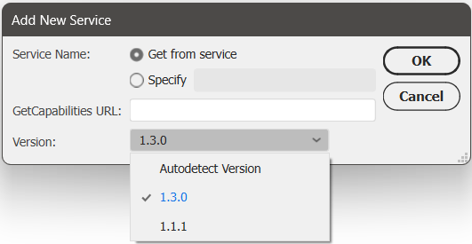
We have had many users request the ability to import data from Web Map Service (WMS) version 1.3.0, and we are happy to announce that this is now possible with Geographic Imager 6.9! This can be done by opening the Advanced Import window and following the usual steps to add a web map service. Select 1.3.0 from the new Version drop-down menu, or select the “Autodetect Version” option in this menu, which can detect the WMS version used by the URL provided.

Support for NITF metadata

NITF metadata will now be maintained when you import NITF files into Geographic Imager. When you go to quick save a document to NITF file format, you will now be met with an “NITF Options” dialog box. Here you can specify image compression, edit certain metadata fields, and choose which metadata fields to include in your saved NITF file.

Geographic Imager 6.9 is Available Now!

If you would like to learn more about the new Geographic Imager 6.9 features or have any questions, please check out our Support Centre.

Geographic Imager v6.9 is available immediately, free of charge to all current Geographic Imager users with active maintenance subscriptions and as an upgrade for non-maintenance users.

Avenza Releases Geographic Imager 6.9 for Adobe Photoshop

Toronto, ON, December 17, 2024 – Avenza Systems Inc., producers of the Avenza Maps® app for mobile devices and geospatial extensions for Adobe Creative Cloud®, including MAPublisher® for Adobe Illustrator®, is pleased to announce the release of Geographic Imager® version 6.9 for Adobe Photoshop®. This version introduces official compatibility with Adobe Photoshop 2025 and macOS Sequoia, WMS 1.3.0 import capabilities, support for NITF metadata, and also includes user interface and usability enhancements.

Geographic Imager for Adobe Photoshop delivers an all-encompassing solution for importing, editing, and exporting geospatial images, such as aerial and satellite imagery. Work with digital elevation models, GeoTIFFs, and other popular GIS image formats using Adobe Photoshop features such as transparencies, filters, cropping, and image adjustments while maintaining georeferencing and support for hundreds of coordinate systems and projections.

New features for Geographic Imager v6.9 for Adobe Photoshop include:

  • Adobe Creative Cloud 2025 compatibility: Geographic Imager now supports Adobe Photoshop 2025 (version 26.0) on both Windows and Mac.
  • macOS Sequoia compatibility: Geographic Imager also officially supports the new macOS Sequoia (version 15) update.
  • WMS 1.3.0 import capabilities: Geographic Imager now supports the import of data from Web Map Service (WMS) version 1.3.0, with an option to autodetect the WMS version also added.
  • Support for NITF metadata: NITF metadata will now be maintained when NITF files are imported into Geographic Imager. Users can also specify image compression, edit certain metadata fields, and choose which metadata fields to include when exporting to NITF file format.
  • Additional user interface and usability enhancements

To utilize the improvements and enhancements offered in Geographic Imager v6.9, users require a valid Adobe Creative Cloud subscription and a compatible operating system. For questions and information on how compatibility requirements may affect your organization, please contact our Support Centre.

Geographic Imager v6.9 is available immediately and free of charge to all current Geographic Imager Maintenance Program members and starts at US$399 for non-maintenance upgrades. New fixed licenses start at US$859. Geographic Imager Basic Edition licenses start at US$129. Academic, floating, and volume license pricing is also available. Visit www.avenza.com/geographic-imager for more information.

More about Avenza Systems Inc.

Avenza Systems Inc. is an award-winning, privately held corporation that provides cartographers and GIS professionals with powerful software tools to make better maps. Avenza also offers the mobile Avenza Maps app to sell, purchase, distribute, and use maps on iOS and Android devices.
For further information contact: +1 416-487-5116 – info@avenza.comwww.avenza.com

###

PDF Press Release

Announcing the Avenza Map Contest 2024 Winners

We are thrilled to announce that the 2024 Avenza Map Contest has officially wrapped up! This year, cartographers from around the world submitted their finest work, showcasing remarkable creativity and skilled cartographic design. Our entrants demonstrated how they harness the capabilities of Avenza software to create impactful and visually appealing cartographic products. With the judging, discussion, and review process now concluded, the Avenza team proudly congratulates this year’s prize winners!

In the coming months, stayed tuned for our Map Spotlight blog series, where we’ll highlight the winning entries and some honourable mentions of the 2024 Avenza Map Contest. Each article will dive deeper into how the winning maps were crafted, featuring insights from their creators, and an exploration of the tools and techniques behind their award-winning designs.

Grand Prize Winner


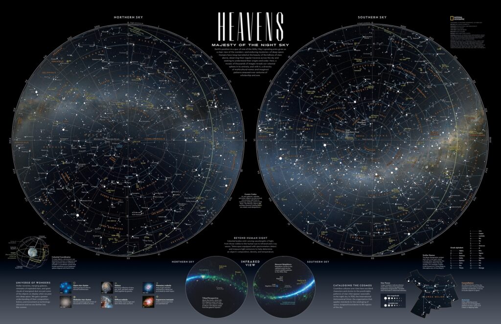
Heavens: Majesty of the Night Sky
Matthew Chwastyk
National Geographic

Connect with Matt on X (Twitter) @mapchwastyk. Additional contributors to the map are Patricia Healy, Heidi Schultz, Eve Conant, Caroline Braun, Scott Zillmer, and Sandi Owatverot-Nuzzo.

Runner-Up Prize Winner


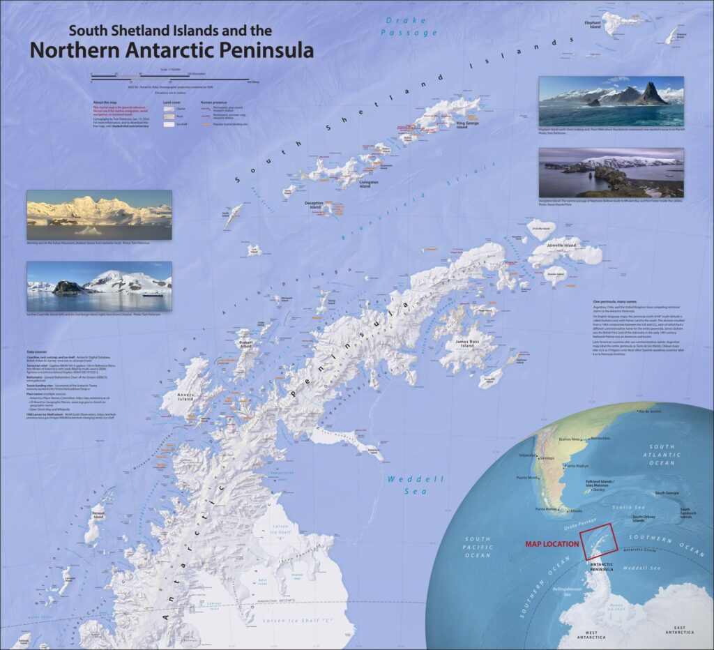
South Shetland Islands and the Northern Antarctic Peninsula
Tom Patterson
US National Park Service (Retired)

Learn more about this map and check out Tom’s other maps on his website. You can also download it from the Avenza Map Store for free! connect with Tom on X (Twitter) @mtnmapper.

Second Runner-Up Prize Winner


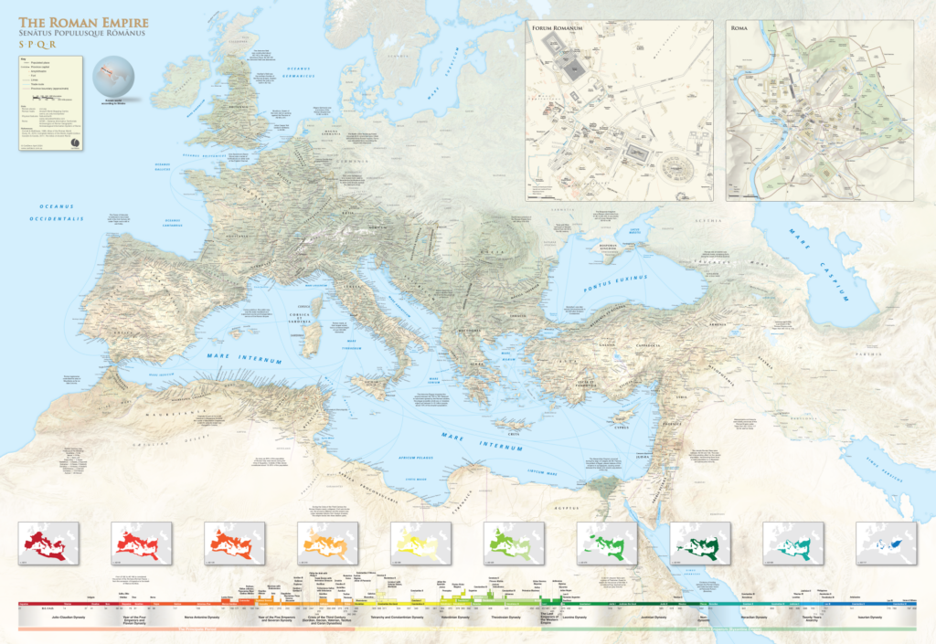
The Roman Empire
Craig Molyneux
CartDeco

This map can be purchased as a 1600 x 1100 mm print on the CartDeco website.

Congratulations again to this year’s winners!

News Archive