


MAP Views are designed to provide an easy method of accessing settings for specifying and transforming coordinate systems, for editing scale and data placement on the page and for exporting to GIS formats. The MAP Views panel allows for merging Adobe Illustrator layers, georeferencing existing Adobe Illustrator artwork, changing multiple layer names, and reprojecting data on the fly.
That said, it’s possible to create multiple MAP Views that each contain a different projected coordinate system in a single map document. The MAP Views panel can be used to move Adobe Illustrator layers from one MAP View to another, enabling to reproject vector art quickly. Layers can be moved via drag-and-drop or with the new Switch MAP View button. This is useful when testing how a variety of projections may fit into your layout. It’s also useful for creating inset or key maps.
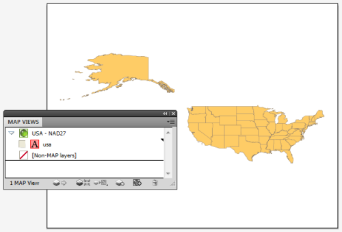
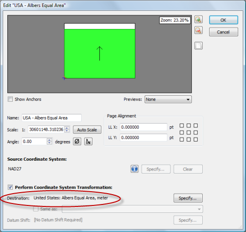
Here we have one MAP View called USA – NAD27. As the name of it implies, it is in a NAD27 projection. Let’s go ahead and make another MAP View so that we can perform an easy transformation.
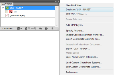
Click the USA – NAD27 MAP View to highlight it, then click the panel option menu (upper right corner) and click Duplicate “USA – NAD27”.
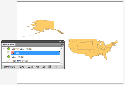
This creates a Copy of USA – NAD27 MAP View. Double-click the Copy of USA – NAD27 MAP View to edit it.
In the MAP View editor, change the title to USA – Albers Equal Area in the Name box. Below you can see that it is currently in NAD27. Check the Perform Coordinate System Transformation check box and click Specify. In the Specify Coordinate System dialog box, in the Folder list, navigate to Projected > North America > United States and click United States: Albers Equal Area, meter in the right-hand pane. Click OK.
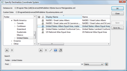
Back in the MAP View editor box, you’ll see that the Destination is updated to show the United States: Albers Equal Area projection. Click OK.
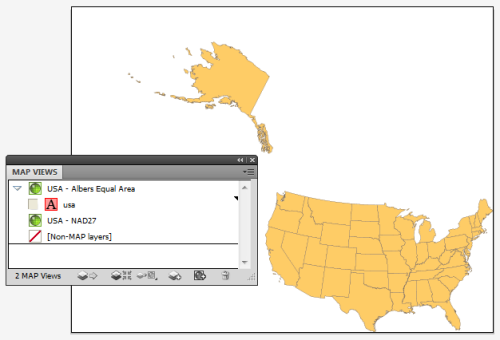
The map is reprojected from NAD27 to Albers Equal Area.
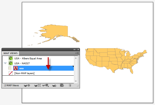
To reproject-on-the-fly by drag-and-drop, click the usa area layer and just drag it to the USA – NAD27 MAP View. Now you can switch back and forth between projections. You may want to duplicate the usa area layer in the Layers panel so that you can have two different projections at the same time. Remember to use the MAP View editor if you want to move a MAP view to retain spatial referencing.
To learn more about MAP Views, view Chapter 4 of the MAPublisher user guide.