My Account     Contact Us     Cart

Avenza Announces 2011 MAPublisher Training Schedule

– New Class Features Thematic mapping, Geospatial PDF creation and LabelPro –

Toronto, ON, November 10, 2011 – Avenza Systems Inc., producers of MAPublisher cartographic software for Adobe Illustrator and Geographic Imager spatial tools for Adobe Photoshop, is pleased to announce the 2011 schedule for its comprehensive 2-day MAPublisher training course. This 2-day class offers in-depth MAPublisher training that will enable MAPublisher users to maximize their use of MAPublisher and fully exploit its features and power.

MAPublisher training is offered in hands-on computer labs at locations around North America. Training is also available onsite at customers’ locations and online in which case certain aspects of the course will be tailored especially for the specific organization and workflow.

Features of the 2011 round of MAPublisher classes include content on creating interactive data-rich Flash maps, geospatial PDF creation, new thematic mapping funtionality and MAPublisher LabelPro advanced text placement.

“I did find the training session very informative and I did learn a fair amount in those two days. I am impressed with the capabilities of MAPublisher and I will definitively recommend MAPublisher and the training session to any of my colleagues working in the map design industry”, said Carlos Serpas of SAIC Polytechnic.

2011 MAPublisher Training Dates & Locations

  • Phoenix, AZ – February 3 & 4
  • New York City area – March 31 & April 1
  • Chicago, IL – May 19 & 20
  • San Diego, CA – July 14 & 15
  • Washington, DC area – September 15 & 16
  • Seattle, WA – November 3 & 4


Course details

  • The cost is US$1,000 per person. Discounts are available for 3 or more attendees from the same organization and for returning students desiring a refresher or update.
  • This is a hands-on course in a computer lab. Computers and required software will be provided.
  • Attendees will learn how to use the most powerful features of MAPublisher as well as all the new features of the latest versions of MAPublisher.
  • MAPublisher for Illustrator on Windows is the focus of the course. Mac users will also benefit from the content and are encouraged to attend.
  • Attendees are encouraged to send in and/or bring their own data and time will be devoted to working with specific user-supplied data and workflows.


Who Should Attend

  • cartographers using GIS data
  • existing MAPublisher users who want to experience the new features of the latest version of MAPublisher
  • existing MAPublisher users who want to get the most out of their MAPublisher license
  • GIS professionals who want to produce better quality maps
  • anyone making maps that wants to leverage the benefits of this powerful software

More about training

Register for training now

More about MAPublisher

MAPublisher for Illustrator is powerful map production software for creating cartographic-quality maps from GIS data. Developed as a suite of plug-ins for Adobe Illustrator, MAPublisher leverages the superior graphics capabilities of these graphics design applications. Full details are available at www.avenza.com.

More about Avenza Systems Inc.

Avenza Systems Inc. is an award-winning, privately held corporation that provides cartographers and GIS professionals with powerful software tools for making better maps. In addition to software offerings for Mac and Windows users, Avenza offers value-added data sets, product training and consulting services. Visit www.avenza.com for more details.

New Transformation Method for World Maps in Geographic Imager 3.2

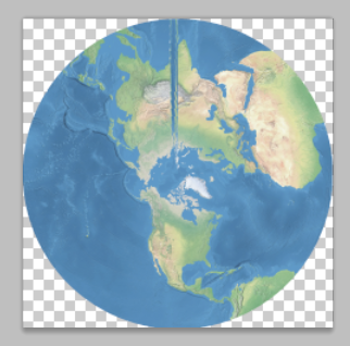
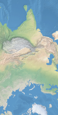
When transforming a world image, there may be artifacts created by the Geographic Imager transformation engine. Below are the results of a WGS84 world image transformed into a Stereographic projection.

Geographic Imager 3.1 transformation result

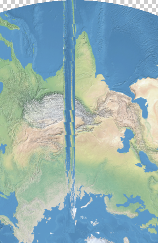
When we zoom into the problematic area, you can see up close how some artifacts affect the image after the transformation was performed.

Geographic Imager 3.0 transformation result 2

To solve this issue, we are introducing a new projection method called Maximum: World Projection in Geographic Imager 3.2.

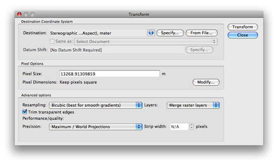
We are going to use the same world image used with the previous example and transform it into the stereographic projection. Take a close look at the Advanced Options.

Geographic Imager 3.2: Transformation Dialog box

Under the Performance/quality section, select Maximum / World Projections from the Precision drop-down list and click OK.

Geographic Imager 3.2: Maximum / World Projections option

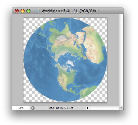
Below is the result of the transformation with the new method available in Geographic Imager 3.2.

Geographic Imager 3.2 transformation result

Let’s take a close look at the same area where the problem happened with the previous version of Geographic Imager. Now the transformed image does not contain any artifacts.

Geographic Imager 3.2: result (zoom in!)

This option is available since Geographic Imager 3.2. The official version of Geographic Imager 3.2 is available now.

Changing the Point Angle using Expressions and Attribute Values in MAPublisher

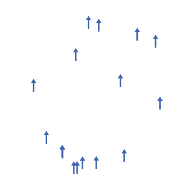
Here we have placed point symbols for a MAP Point layer. However, we want to change the point angle using the Attribute values.

Step 0: my point (not rotated)

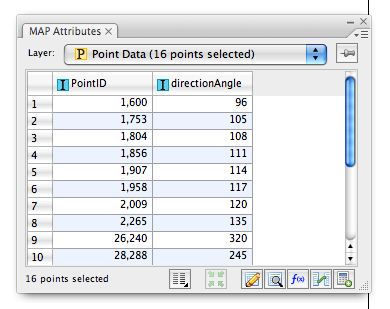
Below is the attribute table for the point data shown above. The field directionAngle is the field containing the symbol rotation value. With MAPublisher, it’s possible to assign this value to every symbol in this layer.

step 1: Attribute data

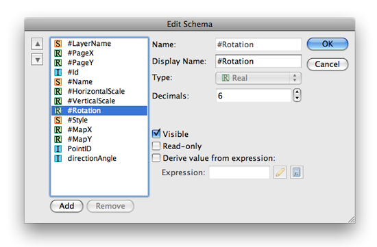
Open the Edit Schema dialog box from the MAP Attribute panel. Find the field called #Rotation from the attribute field list. This #Rotation field is hidden/invisible by default. Click the Visible option to enable it and click OK.

MAP Attributes > Edit Schema

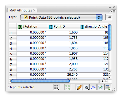
In the MAP Attributes panel, you can see that the #Rotation field shown. The values in this field is 0.00 degree for every point in the layer. We’ll assign the angle value from the directionAngle field to the #Rotation value .

MAP Attributes panel with the #Rotation field displayed

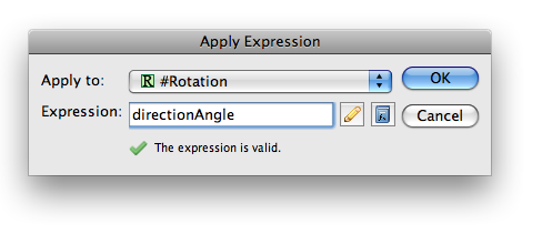
Open the Apply Expression dialog box from the MAP Attributes panel. Enter the column name directionAngle for the Expression and ensure that the value will be applied to the field #Rotation.

MAP Attributes panel > Apply Expression

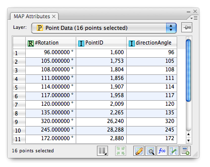
Every value from the directionAngle field is now inherited by the #Rotation field.

MAP Attributes: Angle value assigned

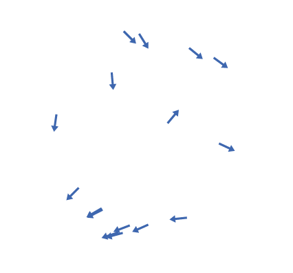
As a result, the rotation angle is now applied to every point.

Point symbols after the angle values are assigned

The origin of the rotation is at each point’s registration point. With Adobe Illustrator CS4 and earlier, the registration point is set at the centre of the point symbol. With Adobe Illustrator CS5, the registration point can be flexibly placed. This will be discussed with some examples in a later topic. Stay tuned!

News Archive